Quantcast
Channel: Frontiers of Anthropology
Viewing all 345 articles
Browse latest View live

More on Microcontinents

$
0
0
http://www.foxnews.com/science/2013/02/25/lost-continent-discovered-beneath-indian-ocean/?test=latestnews

The sands of time: Continent 'lost' 60 million years ago found by scientists

    New continent indian ocean.jpg
  • Beneath the waters of the Indian Ocean lies a hidden "micro-continent," scientists say. (Google / FoxNews.com)
  • New continent indian ocean 2.jpg
    The numbers in the circles are ages in millions of years. The areas with topography just below the sea surface are now regarded as continental fragments, scientists say. (GFZ/Steinberger)
Hidden beneath the brilliant blue waters of the Indian Ocean lies a secret, scientists say: an entire micro-continent that detached itself some 60 million years ago.
And they found it through a few handfuls of sand.
The islands Reunion and Mauritius, both well-known tourist destinations off the southeastern coast of Africa, are hiding the micro-continent, a fragment known as Mauritia that detached while Madagascar and India drifted apart during the Precambrian era, scientists said.
It had been hidden under huge masses of lava. A group of geoscientists from Norway, South Africa, Britain and Germany published a study that suggests, based on the study of lava sand grains from the beach of Mauritius, the existence of further fragments.
The sand grains contain semi-precious zircons aged between 660 million and 1.9 billion years, which is explained by the fact that the zircons were carried by the lava as it pushed through subjacent continental crust of this age.
"We found zircons that we extracted from the beach sands, and these are something you typically find in a continental crust. They are very old in age,” Prof. Trond Torsvik, from the University of Oslo, Norway, told the BBC.
Three-quarters of a billion years ago, the surface of the Earth looked very different than it does today; the planet’s continents were joined in a vast supercontinent called Rodinia. And at the time, India nestled up against the island of Madagascar.
It seems Mauritia was sandwiched between the two.
And it may not have been alone: Such micro-continents in the oceans seem to occur more frequently than previously thought, according to Torsvik’s study.
The break-up of continents is often associated with mantle plumes: giant bubbles of hot rock that rise from the deep mantle and soften the tectonic plates from below, until the plates break apart at the hotspots.
Eastern Gondwana -- another early supercontinent -- broke apart about 170 million years ago in just such a process, the scientists say. At first, one part was separated, which in turn fragmented into Madagascar, India, Australia and Antarctica, which then migrated to their present position.
Plumes currently situated underneath the islands Marion and Reunion appear to have played a role in the emergence of the Indian Ocean.
This dating method was supplemented by a recalculation of plate tectonics, which explains exactly how and where the fragments ended up in the Indian Ocean. Bernhard Steinberger of the GFZ German Research Centre helped calculate the hotspot trail.
"The continent fragments continued to wander almost exactly over the Reunion plume, which explains how they were covered by volcanic rock," he said.

The Mysterious Moroccan Megalithic Menhirs of Mzora

$
0
0
The Heritage Journal
This Journal has been maintained by Heritage Action since March 2005 to promote awareness and the conservation of the incomparable but often-threatened prehistoric sites of Britain, Ireland and beyond. Please add your voice by submitting news, images and articles.

The Mysterious Moroccan Megalithic Menhirs of Mzora

A guest article supplied by Graham Salisbury
They are mystical stones, and of medicinal virtue. The giants of old brought them from the farthest coasts of Africa, and placed them in Ireland, while they inhabited that country. (Geoffrey of Monmouth, The British History of, translated from the Latin by A. Thompson and J. A. Giles, James Bohn, London, 1842, p.158 [Bk 8, Ch. 11].)
I am indebted to Robert Temple for the bulk of the information contained in this article and the majority of the illustrations used appear on his website at http://www.egyptiandawn.info.
In a seldom visited and uninviting part of Morocco, not far from the Atlantic coast, away from major tourist attractions and decent roads lies a remarkable and enigmatic megalithic site.

Figure 1: Old Print of Mzora from 1830 by Arthur de Capell Brooke from http://www.egyptiandawn.info/chapter8.html
The Mzora stone ring (also spelled variously Msoura/Mezorah) is situated roughly 11km from the nearest town of Asilah and about 27km from the fascinating, overgrown ruins of ancient Lixus. It is not easy to reach and guide books to the area are of only very limited use (for a detailed discussion of its precise location including GPS co-ordinates see http://lostcities.weebly.com/1/post/2011/01/re-discovery-of-moroccan-megalithic-stone-circle.html). A small display in the archaeological museum at Tetouan is the most the majority of visitors see or hear of this extraordinary place.
Mzora is largely absent from the historical record but Plutarch, in the first century A.D., may have referred to Mzora in his Life of Sertorius. He describes the Roman General Quintus Sertorius being told by local inhabitants about a site they knew as the tomb of the giant Antaeus who had been killed by Hercules. There are many other ancient accounts that place the tomb of Antaeus in close proximity to both Lixus and Tangier and it is quite plausible that Mzora is the inspiration behind these stories. (Temple, Robert (2010). Egyptian Dawn. London: Century. P386-7).
The site itself is a Neolithic ellipse of 168 surviving stones of the 175 originally believed to have existed. The tallest of these stones is over 5m in height. The ellipse has a major axis of 59.29 metres and a minor axis of 56.18 metres. At the centre of the ring, and quite probably a much later addition, is a large tumulus (the tomb of Antaeus?). Not much remains of this tumulus today, the bulk of the damage to it seems to have been done by excavations undertaken in 1935-6 by César Luis de Montalban. It was he who cut across the mound in two intersecting trenches leaving the distinctive ‘X’ shaped scar visible today (Temple, Robert (2010). Egyptian Dawn. London: Century. p378).

Figure 2: Aerial view of Mzora Stone Circle from Google Earth
The only professional survey of the site was conducted in the 1970s by James Watt Mavor, Junior of the Woods Hole Oceanographic Institute in Massachusetts, USA. It is this survey that revealed Mzora to be not only remarkable in its own right but to have implications for the history of megalithic sites in Britain.

Figure 3: Mavor Survey and Aerial photo comparison
As hinted at by Geoffrey of Monmouth above, Mzora, incredibly, appears to have been constructed either by the same culture that erected the megalithic sites in France, Britain and Ireland or by one that was intimately connected with them. The ellipse is constructed using a Pythagorean right angled triangle of the ratio 12, 35, 37. This same technique was used in the construction of British stone ellipses of which 30 good examples survive including the Sands of Forvie and Daviot rings.
Of the use of Pythagorean triangles in British sites Professor Alexander Thom remarked:
“The remarkable thing is that the largest, the 12, 35, 37, was known and exploited more than any other with the exception of the 3, 4, 5.” Thom, Alexander (1967). Megalithic Sites in Britain. Oxford: OUP. p.27.

Figure 4: Mavor Survey Ellipse from http://www.egyptiandawn.info/chapter8.html
Furthermore it appears that the same unit of measure, the megalithic yard (or something remarkably close) used in the construction of the British sites surveyed by Thom, was also used in the construction of Mzora:
“If a ‘megalithic yard’ of 0.836 metres … [is used] … then the major axis and the perimeter of the ring take on values nearly integral.”Temple, Robert (2010). Egyptian Dawn. London: Century. p379.
Thom proposed that achieving a circumference measured in whole numbers was of paramount importance to the builders of megalithic rings:
“When Megalithic man set out a circle with a diameter of 8 units he found the circumference very nearly 25 units but in general he could not get nice whole numbers like these for both the diameter and the circumference simultaneously. Probably the attraction of the ellipse, and we know of over 30 set out by these people, was that it […] was easier to get the circumference near to some desired value.” Thom, Alexander (1967). Megalithic Sites in Britain. Oxford: OUP. p.31.
Mzora isn’t the only stone circle in Africa to share its construction methodology with British sites. The Nabta Playa stone ring in Southern Egypt conforms to Alexander Thom’s “Type I egg” geometry.
But there are further wonders. According to the diagram below by James Watt Mavor the following astronomical phenomena are marked by the circle:
Stone 30 marks the summer solstice sunrise.
Stone 146 marks the summer solstice sunset.
Stones 61 and 62 mark the winter solstice sunrise.
Stone 118 marks the winter solstice sunset.
Stone 47 marks the equinoctial sunrise
Stone 132 marks the equinoctial sunset
Temple, Robert (2010). Egyptian Dawn. London: Century. p391.

Figure 5: Mavor Survey Stone Numbers from http://www.egyptiandawn.info/chapter8.html
In Mzora we have a fascinating and important site that challenges many assumptions about stone circles in Britain as well as raising a great many more questions. At present the site is unmanaged, exposed and vulnerable. It is a great injustice that this monument isn’t given world heritage status and the protection it richly deserves.
For further discussion of the importance of this site see Chapter 8 of Robert Temple’s book, Egyptian Dawn (2010).
©Graham Salisbury 2011
 
2 Comments:
there is now a warden at the site and a signpost from the main road from larache to tetouan,its about 3 kms after the village of souk tnine de sidi el yamani( a mere petrol stop),heading for tetouan on the left hand side.i visited the site in late january this year2012.
I visited this site (M’Zopra) in 1982 and was astonished to see a similarity to the megalithic Newgrange site in Co. Meath, Ireland. No archaeologist in Ireland was aware of this similarity. I was pointed towards it by an Italian archaeologist. Subsequently I met James W. Mavor and his brilliant paper confirmed my belief that early Irish constructions were ultimately inspired by North African designs.
I produced 4 films on the subject (Atlantean) in 1984 and wrote books referring to it (Atlantean Irish, Quartet Books 1986 and The Atlantean Irish, Lilliput Press, 2005/11)
I am now revisiting the subject of Carthage as an early coloniser of Ireland.
Bob Quinn
 
[--Of course Tartessos preceeded Carthage by a wide margin and these structures were began before Tartessos and of the same original culture. Several stone circles include the circle-cross design such as this one has. The earliest circular patterned sites around the Mediterranean area go back before ten thousand years old and perhaps older than twelve thousand years old.  Large circular structures in the Atlas mountains area have been associated with Platos' story of Atlantis since Roman times. - Dale D.]

Tianyuan Man Linked to Modern Chinese

$
0
0
From the site Global Warming and Terraforming Terra:
Posted: 07 Mar 2013 12:00 AM PST


This is very encouraging. I am certain that many separated populations arose during the Ice Age and developed most of the distinct features associated with those regions. It just makes good sense. On the other hand, a new influx of genes, particularly if they are highly adaptive, would soon integrate into the indigenous populations.

We have always tried to explain this process as one of violence in which the losers die when it is nothing of the kind. The losers may well die, but the breeding women are inevitably conserved. Thus a successful adaptation inevitably finds its way everywhere.

During the past ten thousand years we have had the particular emergence of agricultural man in several separate locations around the world. Mere population expansion has subsumed all other local generic material but has not expunged any of it. Such loss is actually a rarity.

In time we will have enough data to begin the interesting task of unraveling treads of inheritance even back to origination point.


Tianyuan Man scientists unlock secrets of ancient DNA

Scientists who cracked the provenance of Beijing bones have proved to be trailblazers in retrieving and analysing ancient human DNA

Stephen Chen

7 February, 2013


The discovery of ancient human bones in Tianyuan Cave, in Zhoukoudian, Beijing, 10 years ago caused a sensation. They showed Tianyuan Man died about 40,000 years ago.

It was the first time that early human remains had been found in the area since the discovery of Peking Man in 1920s. But Peking Man's skull and other specimens were lost in the chaos of the Japanese invasion during the second world war.

The remains of Tianyuan Man consisted of more than 30 fragments, including lower jaw and leg bones, but no skull - not enough to tell how closely the ancient human related to present-day Chinese. Some palaeoanthropologists were not even sure the bones belonged to a male.

Tianyuan Man reclined quietly in the fossil room of the Institute of Vertebrate Palaeontology and Palaeoanthropology in Beijing. He was almost forgotten until a team of Chinese and German researchers reopened the dusty box and scrutinised the bones with the newest tools of DNA analysis.

What they found was important: Tianyuan Man's DNA came from people who were ancestors not only of many present-day Asians but also Native Americans. It also suggested that people in China at the time were already different from Europeans. The results were published last month in theProceedings of the National Academy of Sciences in the United States.

But the biggest surprise in the study by the Chinese Academy of Sciences and the Max Planck Society was not the results, but the method used to achieve them.

It was the first time scientists had found an effective method to retrieve and analyse ancient human DNA from remains outside permanent frost zones.

Detective work on ancient DNA has become a science fiction cliché, with DNA preserved in amber being used to resurrect dinosaurs in the Hollywood blockbuster Jurassic Park. In real life, however, it has never been so easy, and palaeoanthropologists had only been able to recover the DNA of Neanderthals in Germany and Denisovans in Russia, extinct homo species who lived in arctic-like cold.
For the team studying the Tianyuan remains, contamination posed the first challenge.

Institute deputy director Gao Xing said that when palaeoanthropologists found the bones a decade ago they had not considered the possibility of DNA analysis and took no precautions against contamination. Researchers passed the bones from hand to hand for examination and at the press conference announcing the find, the bones were laid out on a table for viewing and photos. Many people were so close that their breath could have carried their DNA to the bones.

Max Planck Society researcher Fu Qiaomei , the first author of the paper, said she had flown one of the bones to Germany and prepared the samples with laborious procedures in the finest laboratory for ancient DNA analysis. They were delighted to find the DNA had not been contaminated by modern people.

But the scientists immediately encountered another problem. The DNA of Tianyuan Man accounted for less than 0.03 per cent of the total DNA extracted from the sample; the rest was mostly the DNA of germs. No commercially available equipment could analyse such a tiny amount of material.

A new method had to be developed to overcome the shortage of material, which had doomed many previous attempts to decode ancient DNA.

Fu said the traditional approach in DNA analysis was like casting a net in a lake - useful when fish were abundant but ineffective when there were only a few small fish in the water. "We came up with a method similar to pole fishing," she said. "With the right bait we could fish out the ancient DNA to fill up a more or less complete genome template."

The method worked, and the results solved some suspenseful scientific puzzles about Tianyuan man.

Although some Chinese researchers had theorised that he was an ancestor of present-day Chinese, the scarcity of bones made it a wild guess at best. But the DNA results confirmed it, showing that Tianyuan Man was not only an ancestor of Han Chinese but also of many people in Asia, including Thais and Koreans. He was also quite similar to Native Americans.

Scientists have more or less agreed that the first ancestor of humans originated in Africa millions of years ago, but they still have heated debates on the origins of modern humans.

Some scientists proposed in the 1980s that all present-day humans could be traced back to an African Eve who left the continent more than 220,000 years ago.

In recent years, however, the African Eve theory, which relied heavily on the evolution of the mitochondrial genome, has come under fire.

Some palaeoanthropologists in China, for instance, said fossil evidence showed that present-day Chinese evolved from a population that had survived bitter ice ages and resisted the invasion of new migrants from Africa.

The new technology used to study Tianyuan Man will enable scientists to study the DNA of much more ancient humans and cast more light on the ongoing debate. Gao said they hoped to establish a long, continuous record of human evolution from numerous bones unearthed in China, dating from a few hundred years ago to hundreds of thousands of years ago.

"We have many challenges in palaeoanthropology today," Gao said. "We have difficulty establishing a meaningful link between two prehistoric sites. We are running short on specimens. We are puzzled by the culture of early humans. But the future looks bright."
 
[-Presumably the Native Americans most similar to Tianyuan Man would be out of the C,D and G mt DNA lines since the A,B and X mtDNA Lineages are more closely aligned to the Europeans and this study was saying Tianyuan Man was different to the Europeans.
There is also the interesting remark that only less than .003% of the DNA extracted was pertinent and the rest of it was foreign, originating from germs. This immediately points to a hazard in doing such things as analysing Bigfoot DNA; the contamination is already in there-DD]

Giant Skeletons-Newspaper Accounts #2

$
0
0
 

At the top is an illustration of some skulls associated with the newspaper clipping following and the colour picture below it ro different Neanderthal skulls and a modern Homo sapiens skull, reading from left to right (I rearranged the skulls in the top photo to the second row so they would correspond better to the examples in the colour photo)eems that among these various reports of giant skulls and skeletons there are definite strains of both CroMagnons and Neanderthals, and then a category of mixed breeds with somewhat intermediate features. THe raw material of the mound builder giants seems to have come from some of the mixed types, because some of the mixed types were very large, at least as large as the CroMagnons (The modern human in the middle of the top photo is also an EXTREMELY largen skull, with an unusuallu large cranial capacity. Any one of these types can have a greater than normal sized cranial capacity in American skulls generally the large-moderns have the largest braincases)


200,00 years old is about right for Homo heidelbergensis, but they need not have been in North America that long. Louis Leakey suggested about half that old for the Calico Hill site and that might be better.


The cross sign is very important to North American natives quite outside of the Spanish and it denotes the Four directions or Four winds. The skull is of the Old World CroMagnon type, the basic PaleoIndian.
These skulls are interesting because they illustrate three of Neumann's types of skulls: the one in back is the Archaic type of the Eastern Woodlands and has been compared to Iberiands and Western Europeans of the postglacial era. The skull on the left is of the Basketmaker type out of the Southwest USA and the type also goes back into the Archaic: this one has a markedly African character. The associations of the peoples in these two areas with the Iberians and North Africans is insisted on by Barry Fell: older books would have called the Basketmaker skull "Negroid" because this one is very pronouncedly African (Others are more nearly Mediterranean in type) The one very high head to the right in front is something out of one of the CroMagnon types, but it has become very short and high. In addition this individal had a form of artificial deformation apack of the head in an unusual slanting way-but this variation is also known to be the product of a specific type of artificial cranial deformation. This is a skull which is tending to be like the Adenas, and the Adenas are the ones that are most often at the base of "Giant Mound burial" stories. Female Adenas could average six feet tall or over and males at seven feet tall or over according to Robert Silverberg in the standard work The Mound Builders. antic individuals would go up from that point. Below is an Adena mound, mostsimilar to the conical mounds built in Europe by the more recent and shorter, high-headed population there. The culture that built Stonehenge also built conical mounds like this and they were remembered in Folklore as Giants.
Mordecai Rodnipoff III has provided the bulk of the material here, except for my comments on the skulls, which are an area of study I have specialised in. I do give him thanks and the credit for collecting the lippings. There are many, many more clippings like them on file.

"Kama Sutra" Pieces

$
0
0
Back in January I got a message from Gem Wilson which I am reproducing here. I have had hos and followup outpatient visits since then owing to injuries to my lower legs, and so I could not run the piece until now. But it is interesting and warrants further attention:

hi i got your email address from frontiers of anthropology. i have eleven kama sutra pieces that look exactly like the ones in your blog. your blog is the only information i can find on these pieces. i have been trying to find out their values and possibly who would buy them. if you could help me out it would be greatly appreciated
sincerely, gem  
 
Ceramics like these are widely known in Anthropological circles and frequently sold to curiosity-seekers in Mexico. They are thought to be of some relation to the Tlatilco images and of approximately the same age as the Olmec culture. Theyong resemblance to some early Indian ceramics, particularly those associated with the Indus Valley civilisation. Opinion has been advanced before that these were made primarily by women at first, and it is possible that these were made as teaching aids for demonstrating sex positions for young people to learn from.


If any other readers have any more information or questions, or would like to purchase some of these pieces, I have Gem's email address and I can make the connection for you.
Best Wishes, Dale D.

Guest Blogger Jayasree on Sundaland and Indus Civilisation @7500 BC

$
0
0
[7500 BC is the END of the Ice age catastrophe millenium of destruction following the giant meteor strike if we are going on a  straight (unadjusted) radiocarbon date for that strike. A number of people prefer to use an adjusted C14 date for the event, but I think that is an error. I think the adjustment is not warranted and that the perod of 8500-7500 BC is filled with seismic repercussions and volcanic echoes of the initial shock at just about 8500 BC, Otto Muck's date.Jayasree is using the Radiocarbon-Adjusted date when he says 13000 years ago in the article below but in this he is only following Western authors that say the C14 date adjustment is necessary.-DD]
ttp://jayasreesaranathan.blogspot.in/2012/11/date-of-indian-civilization-pushed-upto.html
Non-random-Thoughts


This blog aims at bringing out the past glory of India, Hinduism and its forgotten values and wisdom. This is not copyrighted so as to reach genuine seekers of these information. Its my prayer that only genuine seekers - and not vandals & plagiarists - come to this site.

Wednesday, November 28, 2012

Date of Indian civilization pushed upto 7500 BC!


The Indus date has been pushed back to 7500 BC, so says a recent research (given below). For those reading through the Ithihasas and Puranas of India, this is not a news at all, for we are able to decipher the history of the world running into tens of thousands of years from these texts. When we read them in conjunction with Tamil sangam inputs, we get a better picture of the past.

For example, the rise of human civilisation in the past one lakh years started in the southern seas in the Indian ocean  “ a fact which most of genetic researchers agree with. It had gone to the Northern hemisphere about 60,000 years ago after the Toba-effect subsided. Then when the North was covered with ice, a shift happened from North to South“ not through India but through China to Sundaland (present day Indonesia). From Mahabharata narration (Anusasana parva, chapter 93) it is known that a migration following the sun's movement happened from north to south. This is cleverly explained in this chapter using the etymological meanings of names of the seven rishis and others.


From a region that was supplying Sibi (Typha angustifolia) in the northern latitudes, people had moved to the South where lotuses were growing. These two plants signify availability of food as these plants were completely edible with each part of them being eaten by people. Sibhi grows well in regions 40 degrees North, thereby locating the region at or near Altai mountains. (green circle in the picture below)


The interesting information from archaeology is that this region had Denisovan population which had become extinct around 40,000 years ago.

http://archaeology.about.com/od/dathroughdeterms/qt/denisova_cave.htm


The interesting part of the find is that the DNA deduced from this find is related to the DNA found in Pacific islands near Australia.

http://www.nature.com/news/2010/101222/full/4681012a.html


This goes to show that the Denisovan population once had its ancestry in the Southern hemisphere. So from south to north, some migration had happened which stayed put near Altai mountains or Siberia. When the climate became unbearable, the surviving population had migrated to the south which is what is being indicated in the Mahabharata (http://ancientvoice.wikidot.com/src-mbh-13:section-93 )

The description of finding of the Lotus in a pond signifies a new era of growth of human population in the south which happened around 30,000 years ago when Sunda land was a brimming landscape. The rationale behind locating this region for new growth of humans is because Yatudhani, the demoness who was involved in that description was said to be hiding in that lotus pond. Yatudhanaus were the Danava asuras who shared the Patala, Hiranyapura (of Hiranya kasipu) with Daityas. Even today many people in China and Vietnam use all parts of lotus for food like how Sibi was / is being used in Altai regions.

A decipherable history can be started from Sundaland which got that name from Sunda“ Upsunda episode in which Tilotthama was a small (like tila, the sesame seed in her name) trigger in the mantle which grew up and blew off the twin volcanoes called Sunda and Upasunda. Shiva turning his head all around to see Tiloththama can only be explained as a matter of samhara (destruction) by fire spewed on all sides of the volcanoes. The volcanoes stripped off the land on which they stood leaving what is now called as the Sunda straits.


An underwater exploration might reveal a blast off in the past.


The entire region of Sundaland was home to Daityas and Danavas until 7000 years ago. Until Mahabharat times, Danavas such as Kalakanjas and Nivata kavachas were there in this land who were defeated by Arjuna. The route taken by Arjuna to reach to these danavas and also the route described by Narada to Matali concur with each other and point out to Sundaland only. The details are being written in my Tamil series first and then translated later to be posted here. For the moment, I am saying these to show that history of 20,000 + years ago at Sundaland had all the trappings of the puranic narrations of daityas and danava asuras. Somewhere closely the early Pandyans rose in deep south around 12,000 years ago that was when the first sangam was established as per Nakkeeranar's account in Irayanaar Kalaviyal.

To tell it in a nutshell, take a look at the picture below.


The regions found within the red circles had scattered land forms about 7000 years ago. The first 3 circles starting from Madagascar from left to right had 49 locations as per old Sangam Tamil texts. (Explanations in the Tamil blog http://thamizhan-thiravidana.blogspot.in based on Valmiki Ramayana description of the southern trail in chapter 41 in Kishkindha khanda)

The huge circle around Indonesia had Daitya and Danava people starting from 30,000 years BP until 7000 years BP. [5500 BC=Black Sea flood]

The Chinese, Japanese and Incas were Daityas.

The Europeans, Celts / Druids were Danavas. They co-existed with Danavas in this region.

Bali was the last powerful king (Daitya) of this region who died around 7000 years BP.

The yellow arrow marks show the dispersal of people during various time periods whenever there were volcanic or earthquake disturbances in this region.

The last dispersal happened about 3500 years ago.[1500 BC] That was when the last traces of old Tamil population in the Indian Ocean also got dispersed. The Pandyan king with some of his subjects managed to survive by taking the route through present day Kerala (Alwaye (Alawaay in Tamil – the name of the capital of the Pandyas of the 2nd sangam period. Known in Sanskrit as Kavatam. Kollam was lost in the seas and re-established as today's Quilon) on the south west tip of India.

Other people deep down the south dispersed to Polyneisan islands. Most of these regions bear similarity to old Tamil culture. Another group managed to cross the Pacific ocean through an underwater path in Nazcal ridge and reached Pacha kamaq and Titicaca. There is enough indication to assume that an under water cave path joins Easter islands and Pachakamaq on the western shore of Andes. Nazcal is Naccal which means Naga or serpent. The underground paths are inhabited by snakes and hence called as Naga territory in Indian culture.


One entry was at Pachakamaq and another was at a cave ending near Titicaca.


(Black arrow shows Pachakamaq entry and red arrow shows cave -entry near Titicaca lake)


Before this, around 7000 years BP the previous oceanic flood was described in Tamil texts. At that time many scattered regions were in the Indian ocean. A major area was Mascarene plateau

The circle around Madagaskar had a land huge enough of the size of Tamilnadu state of India. Called as Mascarene plateau this was high land 7000 years before present. Note the continuing chain leading to western part of India and South India.


At that time most regions south off sundaland were lost in the seas and there was a major shift towards West Indian ocean and near south Indian tip.

Most Danavas, (ancestors of Celts) migrated to North West India (Rajasthan, Haryana) and settled down to the east of Indus. From there they went over to Central Europe via Gandahar. North India was brimming with Vedic culture already then. The Celts carried a rudimentary form of Vedic culture.
Most daityas shifted to Chinese inland.

The previous flood [Superflood 2 of 3: the 3rd was the one about 5500 BC] before this time occurred when the Ice age came to an end. Around 13,000 years BP the western part of Indian ocean had many scattered regions that supported life. People were gradually moving towards north 10 to 15 degrees N as sun's path shifted to north. One group entered through river Sarasvarthy via Dwaraka (of those times, now submerged) from the Arabian sea, another entered through Persian gulf when that was inundated at the end of Ice age.


Those who entered India through Sarasvathi were Manu and they carried with them the already established Vedic culture. Their spoken language was Tamil in unrefined form. The unrefined Tamil was the spoken language of South Indian ocean. You will find its rudiments wherever the population of this region shifted - from Polynesia and Incas to Persia etc.

All Indian languages were derived from Sanskrit and Tamil only. This was recognized by early colonial writers in the 18th century India but later deliberately ignored when evangelical interests overtook all genuine research.

With all these, I also wish to say that the recent finding of the dating of Indus figurines to 7000 BC + is not at all amusing[Frivolous?]. The date of civilisation in this region would go upto 10,000 BC in the coming years with more researches taking place.

- Jayasree

****************

From

http://www.globalpost.com/dispatch/news/regions/asia-pacific/india/121116/indus-civilization-2000-years-old-archaeologists

Archaeologists confirm Indian civilization is 2000 years older than previously believed

Indian archaeologists now believe the ancient Indian civilization at Harappa dates back as far as 7500 BC.
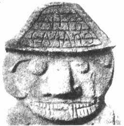
Jason Overdorf


Miniature votive figurines or toy models from the Harappa region of Pakistan, ca. 2500. Recent archaeological findings proove the Indus River Valley civilization is up to 2,000 years older than previously believed. (one_click_beyond/Wikimedia commons)

NEW DEHLI, India ” When archaeologist KN Dikshit was a fresh-faced undergraduate, in 1960, a remarkable discovery pushed back the origin of civilization in the Indus River Valley by some 500 years. Now, he claims to have proof that pushes India's origin back even further ” making Indian civilization some 2,000 years older than previously believed."

"When Bhirrana [Rajasthan] was excavated, from 2003 to 2006, we [recovered artifacts that provided] 19 radiometric dates," said Dikshit, who was until recently joint director general of the Archaeological Society of India. "Out of these 19 dates, six dates are from the early levels, and the time bracket is forming from 7500 BC to 6200 BC."

Since the early excavations at Harappa and Mohenjodaro, in what is today Pakistan, the Indus Civilization has been considered among the world's most ancient civilizations — along with Egypt and Mesopotamia (in what is today Iraq).

In recent times, archaeologists divided the Indus Civilization into the pre-Harappan, mature Harappan and late Harappan periods. The pre-Harappan period was characterized by a primitive, Stone Age culture, while the late Harappan period featured sophisticated brick cities built on a grid system, with granaries, toilets and an as-yet undeciphered written language.

But the six samples discovered at Bhirrana include relatively advanced pottery, known as "hakra ware," that suggests the ancient Harappan civilization began much earlier than previously believed — and that its epicenter lies in the Indian states of Harayana and Rajasthan, rather than across the border.

As Dikshit and his colleague, BR Mani, current joint director general of the ASI, write in a recent note on their findings:

"The earliest levels at Bhirrana and Kunal yielded ceramics and antiquities ... suggesting a continuity in culture, right from the middle of the eighth millennium BCE onwards ... till about 1800 BCE."

That suggests the Harappan civilization is nearly as old as sites from West Asia such as Jericho, where evidence of a neolithic city has been found to date from as early as 9000 BC. But it also means that Harappa, with new proof of hakra ware dating to 7500 BC, may have been more technologically advanced — bolstering India's claim to the title of the cradle of civilization.

"When [John] Marshall excavated the Indus Valley Civilization [in 1922], he gave it the date of about 3000 BC," said Dikshit. "But when [Mortimer] Wheeler came in 1944, he gave a shorter chronology and put the Indus Civilization between 2450 BC and 1900 BC. Those dates were also supported when Carbon-14 dates started to come from other parts of the world."

"In 1960, in Kalimanga, we were only able to push it back a few hundred years. But with these dates [from Bhirrana] things have entirely changed."

Both Dikshit and Mani downplayed competition between India and Pakistan for bragging rights over the Indus civilization ” where the best archaeological site for tourists is in Mohenjadaro, in Pakistan's Sindh province. But the ancient has a way of bleeding into the modern, as various controversies have shown over the years.

Most prominently, perhaps, the so-called "horse theory," rooted in N.S. Rajaram's fraudulent claim that he had deciphered the Harappan script, introduced horses into a concocted history of the Harappan period in order to provide a missing link to the Vedic period in which the oldest scriptures of Hinduism were written.

Noted for his ties with the loonier side of Hindu nationalism, Rajaram pieced together a tale that suggested "Babylonian and Greek mathematics, all alphabetical scripts, and even Roman numerals flow out to the world from the Indus Valley's infinitely fertile cultural womb," according to Harvard Indologist Michael Witzel and comparative historian Steve Farmer.

But for Dikshit and Mani, manufactured controversies of that kind belong in the realm of politics, not archaeology.

"These things should not be raked up," said Dikshit. "I just don't want to give any statement on this. People are talking. There was an Aryan invasion, then Aryan immigration, then horse theory ” this theory, that theory. They are simply wasting their time

Posted byjayasreeat 10:47 PM


12 comments:


Anonymous said...

My few cents (with all due respect):


Theory that people moved from Easter Island to Nazca through under water cave system is not convincing. It would be more convincing to propose that the ridge (before 9600 BC) was above sea level from Nazca to Easter Island and then all the way to Soloman Islands.
November 29, 2012 at 1:13 PM


jayasreesaid...

Thanks for your comment.
The date of migration from Easter island (Polynesian islands) to the Andes (Inca) is around 3500 years ago and not in 9600 BC. We find a uniform connection to this time period in all the available evidences of this region.

First evidence which I strongly rely on is the 3rd submergence of Early Tamil lands that ended the 2nd Sangam period. This took place around 3500 years ago. That was a major catastrophic period in the Indian ocean and in the Indian sub continent too. That was the time Byt Dwaraka (the Dwaraka that came up after Krishna's Dwaraka was submerged) was submerged. Prof SR Rao's research on this submergence can be read on the net. A major earthquake also had occurred in the Saraswathy basin as a result of which the remaining part of the river (on whose banks most of Indus settlements were built) subducted. The result was a dispersal of people which colonial writers characterized as displacement of Dravidians as a result of Aryan invasion.

I mention this with elaboration to drive home the point that it was a major event in Tamilnadu history too. As Dwaraka residents came to Tamilnadu (today's Kongu belt), the displaced Pandyan with his subjects also came to the same region from the south Indian ocean. The details of this goes into many articles which can be read in my Tamil blog.

So 3500 years BP was a major landmark period that saw submergence and inundations that scattered people on all directions.

While Pandyans came through south west tip of India, there were many who were near the Sundalands' south west and southern regions, shifting towards the Pacific. The Lapita pottery, Tangata Manu tradition, olden Tamil practices such as fire walk, mat weaving traditions (of which Pattamadai weaving cult is a rudimentary )and many Tamil and sanskrit words are seen in the Polynesian islands only from 3500 years BP onwards.

One of the activities in these islands is to search for a new region for living. The eldest will automatically inherit the land of the family. The younger ones must have to sail in the ocean and if they find out a new island they can claim that and settle there. Such was the necessity that was there for thousands of years in the past.

Moreover all these polynesian islands were formed by volcanic eruptions. This is a major point of interest. There must be connecting mantle or lava ducts all over this region to give rise to these volcanoes. Once these ducts had cooled they become passages connecting these islands. Note that these passages are underground or underwater passages.

The Nazcal ridge is also one such lava duct seen under water. There is a tradition to call this as Naccal or Naga or serpentine which was recorded by James Churchward of Mu fame. Churchward thought that the epicentre of this name or culture was Japan, but he ultimately found the key to the secret in Kanchipuram in Tamilnadu. (google search Mu or Charchward). The concept of Naga territories under the water is Indian and we can give many instances of Naga people whose dwellings were underground and can be accessed from an opening in the land or hill or a cave.

Near Nagappattinam in the south east Tamilnadu there was a cave opening that led to underground Naga dwellings. The founder of historic Thondai naadu (Kancheepuram) was born to a woman from a cave here - underground Naga dwelling near Nagappattinam - and a Cholan king.

Google search "ninety East Ridge" and you will see the ridge in the Indian ocean which goes upto Nagaland in East India. There were many locations on this ridge conducive for living as per Ramayana account of Shugreeva.

Like this, Nazcal ridge stands a bright chance to offer passage upto South America. The Inca story of first man coming to Pachakamaq and Titicaca are about people coming out of a cave!! The Incas did not come by seas. They came through the caves. Google search Inca or read my Tamil series where these info have already been written.

(cont'd)

November 29, 2012 at 3:26 PM


jayasreesaid...

Two brothers had exited from the caves - one, close to the shore in Pacha Kamaq and another at Titicaca. How could some one exit from a cave on the sea shore? The only possible explanation is that the cave was the exit point of a long under sea passage. The Nazcal ridge fulfills that probability as it is formed by a volcanic duct that subducted under Pacha kamaq!

There are other corroboratory instances too. Incas were known to have built 'Chullpas' (plz google search or read Tamil series). They are nothing but cremation mounds built above the ground. Many Chullpas are now being discovered now in Peru. One interesting information is that the researchers think that all the Chullpas of this region were connected to the Sajama volcano. The chullpas were built on regions where underground lava ducts seem to pass through! You and I or any one in today's world do not know how to identify an underground lava duct pathway. The Incas knew!

Chullpas standing on a duct, probably was a better option to cremate the body. The interesting info on Chullpas is that entire families were cremated in Chullpas. That is, a chullpa is menat for the entire family. When some one dies, his or her body will be pushed through the only opening in the Chullpa and closed. The volcanic heat felt through the duct perhaps helped in disposing the body in the Chullpa.

Such a practice could have come into existence only among the people who lived in a region inevitably surrounded by volcanoes. The only such location in the world in a datable past was Sundaland. Due to paucity of land, the dead ones must have been pushed into a volcano in Sundaland. The people who had that practice in ancient times must have continued it in a new environment by building volcano shaped Chullpas and by connecting them with a nearby volcano.

Such a people must be more knowledgeable than anyone else in identifying underground or under water passages of lava ducts and explored them in the past. Such an exploration had come in handy in times of need when a huge earthquake or volcanic eruption had throttled the dwellers of South Indian ocean and Pacific ocean. They took a chance and entered the underwater duct- passages and found themselves at Pacha kamaq.

It must be noted that they first exited at Pacha kamaq. Another group further explored and ended up in the mountains of Andes near Titicaca lake.

They call these two groups as sons of Viracocha. This is Virochana, father of Bali! Viracocha established settlements. But on seeing the settlers not following his diktats, he went back by walking 'on the sea' says the Inca myth! This again shows that he came from the sea not through boats but through some undersea passage!!

All this happened only 3500 years ago when Nazcal was under the sea! The Titicaca (I had reasoned out in my Tamil blog that Titicaca was originally Diti-caca - Diti's people. Virochanva was a Daitya, of Diti!) people grow a kind of grass which is not seen anywhere in the South America but is seen in Easter islands only. It grows in Easter islands for 10s of thousands of years. From Easter island it was transported to Titicaca.

Assuming that the people carried the grass and crossed the seas, the South American shore was 4000 miles away. Then upon reaching the shore, they had to climb the mountains to reach Titicaca which was quite interior and on other side of the mountain top. This is the only visible route.

But if we take cues from Incan ancient stories (which you call myths), the first stop is at Pacha kamaq through underwater passage and then through another cave passage to Titicaca. The journey could have been safe and less weary even if it would take many days. Similar journey through the seas and then to the Titicaca also would take many days. But how many could have survived in the end and how the grass could have stayed fresh for plantation at Titicaca is anybody's guess.

November 29, 2012 at 3:26 PM


jayasreesaid...

Though people had lived in the Andes since 10,000 years ago, the Incas were latter entrants from the Pacific islands. Most other population since 10,000 years BP came through Berring strait from Russia as per Oppenheimer's genetic study. Refer my article on Indus girl and Indra loka

http://jayasreesaranathan.blogspot.in/2011/11/indus-girl-and-indra-loka-have-remnants.html


There I would have theorized that Incan sun god came through that route. But on further research on Mahabharata, and interfacing them with other available proofs, I come to the conclusion that an independent migration had taken place to the Titicaca. At the same time the Sun God Inti can not be any different from Vedic depiction because, the Berring strait route migrants also took with them the Sun concept of Vedic depiction.

November 29, 2012 at 3:34 PM


Murali (Chennai) said...

Dear Madam

This is a very interesting and highly informative. On googling on MU and Churchward, I came across a site, which states that a German Researcher has visited a secret library of ancient tablets in Ekambareswarer temple at Kanchipuram in 2010. ( http://www.philipcoppens.com/mu.html)
If it is true, why can not scholars and researchers like you get access to that library and arrange to micor film the tablets, so that they are preserved for further research.

It is really perplexing why such national treasure should be guarded as secret, instead of making it available for scholars.

Murali

December 6, 2012 at 7:56 PM


jayasreesaid...

Thanks for the comment Mr Murali. This gives me an opportunity to direct the readers to the more analytical works of mine. But they are in Tamil. Please go to this link in my Tamil blog to read and see the tablet that Churchward saw.

http://thamizhan-thiravidana.blogspot.in/2012/11/116_10.html

Even non- Tamil readers are requested to go to this site and scroll down to see the pictures displayed. The 5th picture that you will see as you scroll down is the tablet that Churchward saw.

It was actually the Yantra plate that is commonly seen in many houses in India. This plate was seen by him in the underground room below Ekambaranathar temple in Kancheepuram. He also saw hundreds of such plates there. He managed to take a photo of this plate. The symbols on the plate are not language, we Indians know. Some mantra- prayoga was done and some power was consecrated on this plate. This is purely for religious purpose in Hinduism.


While dealing on anything on Hinduism or Hindusthan, it is better these foreign researchers spend their life time or considerable part of their life in India and grasp the Hindu concepts before embarking on research. Or else they will be producing absurdities such as Aryan Invasion theories and Churchward's 'findings'!

December 6, 2012 at 8:30 PM


Vedic vikisaid...

Bro! Its a nice article, but could you please tell me where was the actual homeland of tamils and also of the vaivasvat manu?? His kingdom was destroyed in a massive deluge and he sailed to heigher lands of gangetic valley, But where did he exactly come from, and which is an older language tamil or sanskrit, or both have been derived from common proto language?? Im quite confused after reading your article, all the recent researches say that the oldest dravidian language is tamil which dates back to 200 BC, and it was derived from a dialect of sanskrit, both north indic aryans and south indians share the same ancestory though....so plz answer my questions!!?? :)

February 5, 2013 at 9:13 AM


jayasreesaid...

@ Vedic viki

There are many articles in this blogspot and in my Tamil series (http://thamizhan-thiravidana.blogspot.in/) where you can get the replies for your questions. May be you can start reading some of them by clicking the tag "Creation" in the side bar. If you know Tamil, read the the link I have given. Tamil - sanskrit connection in the past has been written there.

Now to your specific questions:-

# The deluge in the story of Vaivasvatha Manu happened at the end of Ice age, when sudden rise on water level happened in the Arabian sea. Manu and his men were settled on the west course of South India in the land that was exposed and extended to the west of the western ghats at that time. Search my blog for Graham Hancock and you will get into the articles where I have explained this using his inundation maps.

Dravida Proper was an considerably huge extension west off Maharashtra in the western extended land off the western ghats. That stretch was the only habitable region about 14,000 yrs BP. Until the Mahabharata period, (5000 yrs BP) bits and pieces of that stretch were above the sea level as small islands.

# Manu did not sail to Gangetic valley as the Ganges was still confined to Gangothri glacier then. Manu was pushed by the floods to Saraswathu river which was 4 KM wide at that time - via Dwaraka. That is why Dwaraka as the gate gained importance and was remembered throughout after that, and reclaimed every time it was inundated.

# What were the previous origins of Manu? By the meaning of the name Dravida, I infer that he ran away from a war / fight previously. He means, not just he but his ancestors. The previous incident in my opinion was the war of Daksha in which Shiva and his men destroyed Daksha's people by fire. I consider this as an allusion to the destruction by fire in an earlier era when mankind was huge in the scattered settlements in the Indian ocean. There is a Paripadal (sangam text) verse telling about the destruction caused by each of the Pancha Bhootha one by one in different time periods in the past.

The last destruction was by water, which wiped off the vital link between east Africa and Sundaland in the Indian Ocean. It started around 14,000 years and ended 3500 years ago in 4 spells of which the last 3 spells disturbed Tamil (Pandyan)settlements in the Indian Ocean.


(cont'd)

February 5, 2013 at 11:05 AM


jayasreesaid...

The destruction by fire occurred before this destruction by water. That was about the war of Daksha in which most people perished in the Indian ocean settlements. The remaining people had split into two, with one group moving towards arabian sea corridor and settling on the sea shore wherever the shore or extended land was available going up to the limit of Maharastra - Gujarat (Gujarat was not a peninsula then). These people - since they ran away were regarded as Dravida (the etymological meaning which was later modified by Manu himself as Kshatriya vratya.). They carried the proto tamil - called as 'Kodum Thamizh' which later came to be known as Apa-Brahmsa in Sanskrit

Sanskrit was already developed by then. Even as Manu and other survivors started their lives in the stretch off Western Ghats (they did not go inland of South India, probably because of the ghats as a barrier and also because the interior South India was a dense shrubby region not fit for habitation at that time. Hancock's maps show that.

At the same time, the other group that stayed on had drifted far-South in the Indian Ocean and established Tamil Sangam - of refined Tamil that we speak to day. The Sanskrit was already a developed one by the sages of the previous land before the fire-destruction. In my opinion that was known as Shaka Dweepa at that time. The details of this can be read in my Tamil blog. The varna culture was there and Shiva was the deity who gave the rule book of Dharma at that time. Tamil was the colloquial and spoken language of the people all over that region in the Indian ocean in south and south west Asia, including Sundaland.

After the fire- destruction (Daksha episode), population was reduced and separated which I explained above. The remaining people of that region started the Tamil Sangam which is dated at 12,500 years BP as per Irayanaar kalaviyal, a 10th century book. That is how we have the division of North and South genetic strains that had a common origin earlier.

(cont'd)

February 5, 2013 at 11:05 AM


jayasreesaid...

# This population further dates back to 25,000 years BP when Sundaland was an brimming with habitation. The puranic Sunda- Upasunda must be related to this region with geological meaning.

The Daitya Prahaladha, Virochana and Bali lived in Sundaland. In my opinion Varaha, Narasimha and Vamana avathara occurred in Sundaland. A splinter group after Narasimma avatara had landed in the east coast of Andhra pradesh (Vishaka pattna?) from there. The word Andhra means garland of intestines around the neck - a term which is mentioned in Runa vimochan sthothramm of Lord Narasimha. There is a group in Andhra which is genetically different from all the other people of India. Further studies are needed to check if their genetic markers match with any in regions around Sundaland. It must also be mentioned that Sundaland was the region of Kurma avatara. It was the turtle island that in mentioned by Meso American groups as their ancestral region. Anthropologically giant turtles lived in Sundaland. This land underwent many geological and volcanic disturbances as though a churning of the milky ocean was happening. The name Mandarin to Chinese language perhaps was derived from the Mandara malai base on this Turtle island and the churning of this region which is metaphorical of geological disturbances.

In this region, the equator splits the land as north and south (Deva and Asura). Like this we can keep telling a lot of things - all with the help of Mahabharata narrations. I will be writing them as separate posts in future.

In Hindu texts Sunda land was called as Swarnadweepa - where Hiranyapura of Daitya- Danavas was present. Gold smithy was at its peak in that region. Sanskrit (Vedic)was present at that time. Unrefined, pre-Sangam period Tamil was the spoken language.

Even before that time a former migration from the South to the North via NW India to Central Europe had happened according to genetic studies.

The gold smithy and stone works were carried by Danavas and Mayans to Central Europe. There is a genetic study that says that Neandardals were taught gold works by some advanced people some 40,000 years ago. That advanced people were these danavas.

Another proof of this is the golden Lion man discovered in Germany.
http://frontiers-of-anthropology.blogspot.in/2013/02/ice-age-lion-man-is-worlds-earliest.html

This Lion man concept is Hindu concept, probably originating form Narasimha avatara that happened in Sunda land. I will write this later as an article.

February 5, 2013 at 11:05 AM


jayasreesaid...

@ Vedic viki,

One more thing. You have asked about the homeland of Tamils. If we go into the past as I wrote above, we find that there was NO specific identity as Tamils. People of a vast land spread across the Indian Ocean from Sundalamnd to Magagaskar spoke the proto Tamil which was then called as Madura. Google Madurese - that was also the shoot -up of Madura mozhi. Refer my Tamil blog for this in which I had established this name for ancient Tamil from Ramayana sources. I think I will soon get them translated into English.

Coming to the Tamil homeland, the speakers of early Tamil had spread out geographically over a vast region and were diverse as a people. By 3500 yrs ago, grammatical Tamil was established in all the 3 lands of Tamils namely Chera, Chola and Pandya. It happened with the last deluge when the last batch of Pandyan survivors landed in Madurai.

But by 9th century AD, many mixing of people had happened. As the 9th century Nacchinaarkkimniyar wrote in his commentary to Tholkappiyam, a small stretch of land in Madurai - Tanjore proper had people who spoke original grammatical Tamil around this time. In other words, the Tamil spoken in the early 3 lands of Chera, Chola and Pandya had shrunk to this region. All the rest - that include the different dialects of Tamil were not from Tamil proper people. They all had mixed origins and were from Manu's descendants.

Even the so-called Paraiahs of Chennai - which colonial period census records had recorded as numbering to 3 lakhs at that time, were all of north Indian descendance. They moved to madras then because they were not accepted within their communities for having taken to cow-slaughter and other slaughter during Muslim rule. Their spoken language was Kodum tamil which became Madras Tamil due to influence by English language which they picked up from the British whom they served in the then Madras.


The entire belt from Maharastra / Kolapur to Kanyakumari also had migrants from North India, settled over centuries. Their Kodum Tamil had a different slant and became regional dialects of Tamil in due course.

From all this you will see that identification of Tamil as a people or race has no basis. By speaking Tamil we regard ourselves as tamils.That is all. If we say that by speaking this language, a person gets a Tamil identity, then even the Tonga man in Polynesian islands must be regarded as a Tamil as he was a branch from the early settlement in Sangam period.

February 5, 2013 at 11:43 AM


jayasreesaid...

Dear Mr Murali,

Re-read your comments to day. Please take note that I have
posted a 2 part article in English on Mu and Lemuria. Read them here.

http://jayasreesaranathan.blogspot.in/2012/12/mu-to-lemuria-kumari-kandam-to-sumeria.html

http://jayasreesaranathan.blogspot.in/2012/12/mu-to-lemuria-kumari-kandam-to-sumeria_21.html

Got a response from Jack Churchward that Ritter's Kancheepuram plates were not original. The other plates of Kancheepuram are Tamil scripts of the last 3 centuries and not Mu language script.

February 5, 2013 at 11:50 AM

Guest Blogger Jayasree: Meteor-hit in Russia – some thoughts.

$
0
0

Bosnian Pyramids

$
0
0
From Global Warming and Terraforming Terra site:


Word seems to be that the Bosnian pyramids are definitely of Ice Age date and manmade: they are earlier than 10000 BC, as shown by the age of the soil covering them. There are some pyramids of Latin America that are said to be that old, but the dates are hotly disputed. I think these are genuinely the original wave of pyramid builders out of the Atlantis Empire and associated with the oldest mine operations in Europe, the Mid-East, and in Latin America. And they all seem to be teocallis.-DD


Bosnian Pyramids
Posted: 12 Mar 2013 08:56 PM PDT

It is high time to start taking these structures in Bosnia seriously whatever we may think of the interpretation. Importantly, it is claimed that this is a working pyramid. That is very important.

Even better we have a high quality cement we want to replicate.

As I have been extensively posting, we are steadily unearthing and recovering the shape of the Atlantean world from 3000 BC to 1159 BC and the Bronze ingot currency that drove it. All the core Atlantean centers mustered the man power able to build large pyramids. We are now finding them.

I also see no Atlantean evidence to support earlier chronology. However, this pyramid has been continuously radiating and I do suspect that this will strongly age carbon isotopes and I should mention that the aging limit for carbon is generally 12,000 years and should be labeled alternatively as greater than.

As readers of my blog likely understand, there certainly existed a pre - Pleistocene Nonconformity human world that we can rightly name as Antediluvian. To some degree, it is plausible that a pyramid power source technology existed and was simply abandoned before the crust was shifted. The great pyramid could be part of that while the Atlantean age was correctly one of imitation. [of the previous age]

The high quality concrete is the best argument for an antediluvian chronology and must be taken seriously.

Way more important, this pyramid is intact.


Significance of the Bosnian Pyramid Discovery

by Semir “Dr. Sam”Osmanagich

Foreign member of the Russian Academy of Natural Sciences


It was in April 2005 that I first traveled to the town of Visoko, 20 miles northwest of Sarajevo, the capital of Bosnia-Herzegovina. Two pyramid shaped hills caught my attention at that time, and I later named them the Bosnian Pyramids of the Sun and Moon. For thousands of years locals had considered those pyramidal shapes just natural hills though they did have the shape of a pyramid because they were covered by soil and vegetation. When I first saw their triangular faces, obvious corners and their orientation toward the cardinal points, I knew that they had to be constructed by a force other than nature. I have investigated pyramids for decades throughout the world including China, Mexico, Guatemala and El Salvador and they had the same type of soil and vegetation coverage, I knew they had to be pyramid structures.


In 2005 work was started unearthing these pyramids and various construction companies and geologists were hired to do core drilling and geo-morphological analysis. Then I announced to the world, in a press conference, that the first pyramids in Europe had been discovered.


Shortly thereafter I established the non-profit, Archaeological Park: Bosnian Pyramid of the Sun Foundation, and the investigations in Bosnia have proven this complex holds the world’s largest inter-disciplinary archaeological project. We spent over 340.000 hours in archaeological excavation, sample testing and radiocarbon dating from 2005 until January of 2011. Discoveries have determined that the Bosnian Pyramid Valley consists five pyramids discovered to date which I have named: The Bosnian Pyramids of the Sun, Moon, Dragon, Mother Earth and Love. The site also includes a tumulus complex and a huge underground labyrinth that stretches for more than 10 miles underneath the pyramidal complex.


This discovery is changing history because of several things:

  • These are the first pyramids discovered in Europe
  • The site includes the biggest pyramidal structure in the world—The Bosnian Pyramid of the Sun (over 220 meters high) is 30% larger than the Great Pyramid of Egypt on the Giza Plateau (147 meters)
  • The Bosnian Pyramid of the Sun has the most precise north-south cosmic orientation of any pyramid on earth so far discovered
  • The Bosnian Pyramid of the Sun is completely covered by rectangular concrete blocks. Properties of the concrete, such as extreme hardness and low water absorption, are, according to the scientific institutions in Bosnia, Italy and France, far superior to any modern concrete materials
  • The pyramids are covered by soil (according to the state Institute for Agro-pedology) which is over 12,000 years old. This finding confirms the Bosnian pyramids are the oldest pyramids on the planet
  • Below the Bosnian Valley of the Pyramids is an extensive underground tunnel and chamber network which runs for more than ten miles
  • Ceramic sculptures have been discovered in the underground labyrinth with a mass of up to 20.000 pounds which makes them the largest so far found from the ancient world
This list of Bosnian archaeology finds does not end here. In the vicinity, we discovered the tallest tumulus in the World which is 61 meters high. Up until now the highest tumulus known was in Sillbury Hill in England and measure 60 meters high. The Bosnian tumulus consists of two-layers of megalithic terraces, clay layers and artificial concrete layers.


In 2010, a team of physicists who were brought onto the project located detected an energy beam coming through the top of the Bosnian Pyramid of the Sun. The radius of the beam is 4.5 meters with a frequency of 28 kHz. The beam is continuous and its strength grows as it moves up and away from the top of the pyramid. This phenomenon contradicts all known physical laws known to man today. This is the first proof of non-herzian technology on the Planet. It seems the original pyramid-builders in what is now Bosnian created a perpetual “energy machine” that is still working today.


In the underground labyrinth we discovered three chambers in 2010 and a small blue lake. Energy screening shows that the ionization level is 43 times higher than the average concentration outside which makes the underground chambers healing rooms.


Further electromagnetic detection in 2011 confirmed that levels of negative radiation through the Hartman, Curry and Schneider grids are equal to zero in the tunnels. There was no technical radiation (from power lines and/or technology) found in the tunnels and no cosmic radioactivity.


The large ceramic sculptures are positioned over the underground water flows resulting in the negative energy being transformed to into positive energy. All of these experiments point to the underground labyrinth as one of the most secure underground constructions in the world making it ideal for body rejuvenation and regeneration.


Two hundred years of Egyptology has not produced a satisfactory answer to the question of what the real purpose was for building the pyramids. But with only six years of research on the Bosnian pyramids we have applied inter-disciplinary scientific research looking at this complex from not only the physical, but the energetic and spiritual dimensions as well which has produced some astounding information. And, we have pioneered results which affects the science of pyramids which until now has largely been ignored in Egypt. This archaeological project is changing the world as we know it with each new discovery.


Perhaps by exploring new ways of looking at things we can learn from our ancient past by changing our present and make our future better.

    [Note: Robert Klein uses "Atlantean" in the sense of "Atlantic Bronze Age" and it is probably true the people themselves called themselves Atlanteans and identified their lineage as coming from the earlier Atlantis. For the most part the term "Atlantean" in this sense applies to the Megalithic culture of Europe - DD]

    This is the 300th posting on this blog.

First Dynasty Egyptian Text Spelling for Atlantis

$
0
0
I found this while doing a photosearch for something different. This is a transliteration for a place name listed in a first-dynasty (3000 BC) Egyptian hieroglyphic inscription and it seems to correspond to Atlantis. It is not the familiar letter order, it is a little jumbled from what we are used to. Nonetheless this does seem another clear sign that the Atlantis legend is from the beginning of Egyptian history and did not originate in some subsequent event such as the Late Bronze Age eruption of the Thera volcano or the Trojan War.

Atlantis from first dynasty Egypt
[As I understand it, the initial H can be dropped or added by different dialects, as it is in London Cockney. And the Ancient Egyptian did not distinguish between l and r. Best Wishes, Dale D.]

11,000 yr old Star Chart in Egypt

$
0
0

11,000 yr old star chart more accurate than NASA


Published on Dec 25, 2012
The star chart at Nabta Playa is composed of a few stones in the sand and it calculates the position of the star system Orion over the 24,000 year procession and calculates the distance to each star in light years. It is accurate on the stars we know the distances to, but have to assume its correct on the stars that NASA currently does not know the exact distance to. These stones were placed in the desert roughly 7,000 years before the Egyptians built the Pyramids. The purpose of the structure was recently discovered by Thomas G. Brophy.

I DO NOT OWN THIS MATERIAL, nor have any claim to it.
Copyright: 2001 Cydonia Inc, All Rights Reserved
Taken from episode 3 of Magical Egypt.


Out of Africa Date Brought Forward, or Not

$
0
0

Out of Africa date brought forward

March 22, 2013 by Lin Edwards


             Ötzi the Iceman, a well-preserved natural mummy of a Chalcolithic (Copper Age), who was found in 1991 in the Schnalstal glacier in the Ötztal Alps. Credit: South Tyrol Museum of Archaeology (Phys.org)

 —A study on human mitochondrial DNA has led to a new estimate of the time at which humans first began to migrate out of Africa, which was much later than previously thought.
The new study by an International group of evolutionary geneticists used mitochondrial DNA from the remains of ancient modern humans to estimate the rate of genetic mutations. Three of the skeletons were from the Czech Republic and dated at 31,000 years old, two were 14,000 years old, from Oberkassel, Germany. Another sample used was the natural mummy Ötzi the Iceman, who lived some time between 3350 and 3100 BC. The most recent skeleton was that of a man who lived in medieval France 700 years ago, while the oldest was dated at 40,000 years ago, and came from Tianyuan in China. The results suggest that the genetic divergence between African and non-African humans began between 62 and 95 thousand years ago, which tallies with other studies estimating the time through dating of stone tools and fossils, but they disagree with the results of recent genetic studies that estimated the migration began much earlier, up to 130 thousand years ago or even before. The previous studies sequenced the entire genome of living humans to count the number of genetic mutations (around 50) in newborn babies compared to the parents to determine the generational mutation rate. This then provided the a molecular "clock," which could be extrapolated backwards to date important events in human evolution.


            Triple burial from Dolni Vestonice in the Czech Republic. Credit: J. Svoboda

The new study sequenced mitochondrial DNA from fossils of ancient modern humans rather than living humans. The fossils were dated using radiocarbon dating methods. Since the samples were from humans who lived up to 40,000 years ago, mutations that have occurred in the genome since they died would be missing, and the samples provided a range of calibration points for their estimation of the start of the migration.

 The disagreement in dating the migration between the new study and previous genetic research could be due to underestimating the number of new mutations in a generation of living humans because of the difficulty of discriminating between true mutations and mistaken ones and because of a desire to avoid false positives. Under-counting would lead to an older estimate for the migration from Africa and other important events. The new date, which agrees with the archaeological evidence, shows that modern humans were in Europe and Asia before and after the most recent glaciation, and they were therefore able to survive and adapt to a dramatically changing climate. The paper was published in the journal Current Biology on 21st March.
More information:
 A Revised Timescale for Human Evolution Based on Ancient Mitochondrial Genomes, Current Biology, 21 March 2013, DOI: 10.1016/j.cub.2013.02.044
 www.cell.com/current-biology/retrieve/pii/S0960982213002157
Journal reference: Current Biology © 2013 Phys.org

Read more at: http://phys.org/news/2013-03-africa-date-brought.html#jCp                                        

 Read more at: http://phys.org/news/2013-03-africa-date-brought.html#jCp
[We are not talking the same migration Out Of Africa bacause we are not talking the same populations. The older divergence accounts for an older stratum of humanity that wound up in parts of Australia and the orient: this is the older migration and this genetic series has nothing to do wityh that. This measures a SECOND Out of Africa migration which led to the peopling of most of the rety of the world and which swallowed upany remants of the older migration. The two migrations can be defined by physical types (skulls) and archaeology (stone tools) and they are separated by the major eruption of the Toba volcano in Sumatra, the greatest known of all volcanic eruptions.--DD]

Lao skull earliest example of modern human fossil in Southeast Asia        

August 20, 2012     
                      
             The researchers found skull fragments that date to 63,000 years ago. Credit: Laura Shackelford               

An ancient skull recovered from a cave in the Annamite Mountains in northern Laos is the oldest modern human fossil found in Southeast Asia, researchers report. The discovery pushes back the clock on modern human migration through the region by as much as 20,000 years and indicates that ancient wanderers out of Africa left the coast and inhabited diverse habitats much earlier than previously appreciated.
The team described its finding in a paper in Proceedings of the National Academy of Sciences. The scientists, who found the skull in 2009, were likely the first to dig for ancient bones in Laos since the early 1900s, when a team found skulls and skeletons of several modern humans in another cave in the Annamite Mountains. Those fossils were about 16,000 years old, much younger than the newly found skull, which dates to between 46,000 and 63,000 years old. "It's a particularly old modern human fossil and it's also a particularly old modern human for that region," said University of Illinois anthropologist Laura Shackelford, who led the study with anthropologist Fabrice Demeter, of the National Museum of Natural History in Paris. "There are other modern human fossils in China or in Island Southeast Asia that may be around the same age but they either are not well dated or they do not show definitively modern human features. This skull is very well dated and shows very conclusive modern human features," she said. No other artifacts have yet been found with the skull, suggesting that the cave was not a dwelling or burial site, Shackelford said. It is more likely that the person died outside and the body washed into the cave sometime later, she said. The find reveals that early modern human migrants did not simply follow the coast and go south to the islands of Southeast Asia and Australia, as some researchers have suggested, but that they also traveled north into very different types of terrain, Shackelford said. "This find supports an 'Out-of-Africa' theory of modern human origins rather than a multi-regionalism model," she said. "Given its age, fossils in this vicinity could be direct ancestors of the first migrants to Australia. But it is also likely that mainland Southeast Asia was a crossroads leading to multiple migratory paths
The discovery also bolsters genetic studies that indicate that modern humans occupied that part of the world at least 60,000 years ago, she said. "This is the first fossil evidence that supports the genetic data," she said. The researchers used radiocarbon dating and luminescence techniques to determine the age of the soil layers above, below and surrounding the skull, which was found nearly 2 1/2 meters (about 8.2 feet) below the surface of the cave. Researchers at Illinois used uranium/thorium dating to determine the age of the skull, which they determined was about 63,000 years old. Research fellow Kira Westaway, of Macquarie University in Australia (who dated the soils around the famous "hobbit" fossil found on Flores Island in Indonesia in 2003), conducted the luminescence analyses. These techniques measure the energy retained in crystalline particles in the soil to determine how much time has elapsed since the soil was last exposed to heat or solar radiation. She found that the layer of soil surrounding the fossil had washed into the cave between 46,000 and 51,000 years ago. "Those dates are a bit younger than the direct date on the fossil, which we would expect because we don't know how long the body sat outside the cave before it washed in," Shackelford said. "This fossil find indicates that the migration out of Africa and into East and Southeast Asia occurred at a relatively rapid rate, and that, once there, modern humans weren't limited to environments that they had previously experienced," she said. "We now have the fossil evidence to prove that they were there long before we thought they were there."                               
More information: "An Anatomically Modern Human in Southeast Asia (Laos) by 46 ka," PNAS, 2012
.Journal reference: Proceedings of the National Academy of Sciences        
Provided by University of Illinois at Urbana-Champaign 

[This skull is hardly "Modern", it is a particularly rugged "Archaic" and could well have been in the earlier Out of Africa migration which was under way by 100,000 (one hundred thousand) BC--Dale D.]


 Read more at: http://phys.org/news/2012-08-lao-skull-earliest-modern-human.html#jCp

http://phys.org/news/2010-10-modern-humans-emerged-earlier-previously.html

Modern humans emerged far earlier than previously thought
 October 25, 2010


  Fig. 1. The human remains from Zhiren Cave. The Zhiren 3 mandible in anterior (A), lateral left (B), and superior (C) views. The midsymphyseal cross-section of the Zhiren 3 mandible (D). The Zhiren 1M3 in buccal and mesial views (E), and the Zhiren 2 M3 in the same views (F). (Scale bar, 5 cm.) (Courtesy of Drs. LIU Wu and JIN Chang-Zhu)

  (PhysOrg.com)  An international team of researchers based at the Institute of Vertebrate Paleontology and Paleoanthropology in Beijing, including a physical anthropology professor at Washington University in St. Louis, has discovered well-dated human fossils in southern China that markedly change anthropologists perceptions of the emergence of modern humans in the eastern Old World.

The research was published Oct. 25 in the online early edition of the Proceedings of the National Academy of Sciences. The discovery of early modern human fossil remains in the Zhirendong (Zhiren Cave) in south China that are at least 100,000 years old provides the earliest evidence for the emergence of modern humans in eastern Asia, at least 60,000 years older than the previously known modern humans in the region. "These fossils are helping to redefine our perceptions of modern human emergence in eastern Eurasia, and across the Old World more generally," says Eric Trinkaus, PhD, the Mary Tileston Hemenway Professor in Arts & Sciences and professor of physical anthropology. The Zhirendong fossils have a mixture of modern and archaic features that contrasts with earlier modern humans in east Africa and southwest Asia, indicating some degree of human population continuity in Asia with the emergence of modern humans. The Zhirendong humans indicate that the spread of modern human biology long preceded the cultural and technological innovations of the Upper Paleolithic and that early modern humans co-existed for many tens of millennia with late archaic humans further north and west across Eurasia.
   Provided by Washington University in St. Louis 


 Read more at: http://phys.org/news/2010-10-modern-humans-emerged-earlier-previously.html#jCp

[Once again, two migrations Out of Africa, the older one around 100000 years ago and freaturing older, more rugged, more "Archaic" human beings most like some of the Australian Aboriginals, who preserve more of the people descended from these earlier colonists than anybody else-Dale D]


East Asian Shorelines on the Piri Reis map

$
0
0

Shipping, Exploring and Mapmaking in the Latest Pleistocene

East Asian Shorelines on the Piri Reis map of AH 919 (AD 1513)

 (Article suggested by Mus Mulyadi)


Copyright © 2004, Jean-Pierre Lacroix (Liège, Belgium) and Robert Bywater, (Melbourne, Australia), Ancient Cartography.
 
Robert Bywater :

rab1@ancientcartography.net

Jean-Pierre Lacroix :
ABSTRACT
The western part of the AH 919 (AD 1513) map is considered by most authors to depict the region of the Caribbean. However, Columbus believed he had been to Asia and Piri Reis wrote that the names in the western area of his AH 919 (AD 1513) map were obtained from Columbus. We considered it was necessary to re-investigate the shorelines depicted in this part of the map. We have used computer superposition to re-investigate the shorelines depicted in the western area of the map. The results suggest that the map depicts shorelines of East and Southeast Asia from the east side of the Kamchatka Peninsula in the north, to northwest Borneo in the south. Interesting results include that the Territory of Antilia is eastern China opposite Taiwan, and Island Antilia is Taiwan but showing bays of Puerto Rico; the authors suggest that the large western island is an erroneous depiction of southern Japan. Based on the superpositions and other supporting geological information, the authors suggest that the western source map used by Piri Reis (whether of Turkish origin or from Columbus) depicted shorelines which were charted prior to the Islamic and Christian eras.

INTRODUCTION
The Piri Reis AH 919 (AD 1513) map fragment (41, 51) was found during renovations of the Topkapi Palace Museum in 1929 (16, 20, 21, 28, 35, 44). The western region is thought to represent the Caribbean (16, 21, 28, 44). Hapgood (16) using a separate Grid "B" for this area identified the western continent as Central America in the vicinity of the Yucatan Peninsula and the coasts further south were suggested to be those of both Central and South America even though some locations were identified twice. The large western island he identified as Cuba.

The identifications made by others (21, 28, 44) are usually based upon inscriptions written by Piri Reis and attributed by him to Qulumbu(Columbus). These suggest that the northwestern coasts are the shorelines of Cuba (in continuity with the coasts of Panama further south) and the large western island is Hispaniola (20, 21, 28, 35, 44, 45). Columbus however believed he had been to Asia (21, 28, 37). In this paper we investigate Asia as a possible origin for the mainland depicted in the western area of the map. The results presented in this paper are essentially similar to those we have reported elsewhere (5).


The map at the top is my own interpretation. I think it is highly important that we have a detailed map of Sundaland and East Asia from this period, and the book Maps of the Ancient Sea Kings already supposes some of the other maps are indicating a Pleistocene Sundaland above water (Other maps show a postPleisocene Indonesia) The original would have been a Portolan or "Ports of Call" map and the area  from Borneo to Japan heavily travelled by merchant ships. We know that something similar was going on in South India at the same time from other sources. At the same time, I would not doubt that the Admiral had access to older maps of the Caribbean and South America which he also compiled with the East Asian maps, following on Columbus' maps and observations. And the three marks near "Antilla" I take to be a reference to maps of three original islands which were combined to make the map on the chart: It is already known that there is a confusion between Atlantis and Antillia, and Cipangu (Japan) on different charts. Here I suggest that  part of the problem is a mistaken combination of Antillia and Antipodes. It is also noteworthy that while Atlantis was a free island surrounded by the sea, the reconstruction used by Lacroix and Bywater calls both Taiwan and Japan peninsulas still attached to the mainland. Certainly there is a general confusion and an oversimplification going on at the time Piri Reis was compiling the old maps. He did do a quite remarkable job of preserving irreplaceable documents. And the missing sections of he map were very likely the same as the Old World mapof Ptolemy, because Pri Re'is mentioned him as a source also.
 
World Map of Ptolemy, ca 100 AD. From Wikipedia.
http://en.wikipedia.org/wiki/Ptolemy's_world_map

The Story of Easter

$
0
0
Carolyn Rose Goyda, a Facebook Friend of Mine, sent me a copy of this yesterday and I posted it to my timeline:


And I added, "And the direct derivation of Easter is from the European Goddess of Spring Oestra, also pronounced about like Ishtar, and from which we get the word Oestrus (Estrus)-when an animal gets into heat. And Oestra is also associated with rabbits and eggs."

But then Kyle Germann added "That might be Lilith" and "She might be the First Vampire"

So I elaborated, "Actually the picture is regularly called that. BUT Lilith might only be a form of Ishtar. Ishtar was also sacrificed by her sister Ereshkigal AND this could be Ereshkigal AND Ereshkigal could ALSO be the same as Ishtar. Its complicated. But the fact that she died-and-came-back is part of the same Goddess of Spring story, which is the same story as Snow White (who sleeps over the Winter) and Sleeping Beauty (Everything blossoms back into life when she wakes up again) http://www.tumblr.com/tagged/ereshkigal

And the Classical Goddess of Spring story is another resurrection story, the one attached to Persephone, who is taken down to Hades but returns each spring
http://www.greekmyths-greekmythology.com/myth-of-hades-and-persephone/


http://www.mlahanas.de/Greeks/Mythology/Persephone.html
http://en.wikipedia.org/wiki/Persephone
http://en.wikipedia.org/wiki/Ishtar
http://en.wikipedia.org/wiki/Ereshkigal

But the notice sent in by Carolyn was a little too simplistic, the death-burial-and-resurrection was already an integral part of the ancient myths, and the return to life meant the return of fertility to the land. The story is also a good marker for cultural diffusion.

Origin of Easter from Ishtar and Ishtar from Hindu Goddess.(part -1)

$
0
0
http://jayasreesaranathan.blogspot.com/2013/03/origin-of-easter-from-ishtar-and-ishtar_31.html

Guest Blogger Jayasree has a series that shall run all week.

Origin of Easter from Ishtar and Ishtar from Hindu Goddess.(part -1)

Sunday, March 31, 2013


The following information on Easter as an adaptation of the idea of Ishtar, the Assyrian and Babylonian Goddess of Fertility makes an interesting reading. The annual revival of the Spring season which was originally identified with Ishtar was adapted by Christianity as the day of resurrection of Christ. For those who are familiar with the Hindu rules of iconography, the concept of Ishtar is seen as an adaptation from the pre-existing images of Mother Goddess of the Hindu pantheon. The mother goddess principle is the oldest in the world and in the Hindu Thought as well. In this article let me share some of my observations on the development of Mother Concept of Hindu Thought and its spread in other parts of the world.

(Picture courtesy :- http://frontiers-of-anthropology.blogspot.in/2013/03/the-story-of-easter.html ) Easter is not a fixed date in the civil calendar. It is fixed on the basis of Full moon that comes after March equinox. It has been found that the day of resurrection of Jesus was adapted from the pre-existing custom of resurrection or revival of Goddess Ishtar from death. This is nothing but a metaphorical way of saying that the new season of spring had arrived after a death like cold season. Interestingly the pre-Christian Europe was following lunation to mark important events. Even the present practice of celebrating the New Year on January 1st came from one such practice. When Caesar wanted to start the New Year on 25th December (which was again a pre-existing date of Birth day of Mitra), the people resisted it because it did not coincide with either New Moon or Full Moon. A few days after that, i.e., on 1st January, 45 BC, New Moon occurred. So that date was chosen as the New Year. The importance given to Full and New Moon in Europe at that time seems to be a continuation of the pre-existing customs of Vedic life. To cite an example of the spread of the pre-existing customs or ideas and their subsequent degeneration owing to loss of connection with or understanding of the original idea, let me take up an idea of Mithraism. Mithra, which the western world considers as a Persian God is a degenerated idea taken out from the Hindu concept of Vedic God, Mithra. Mithra is the friend of cattle and is the cause for rains in Hindu texts. He always tows behind the Sun. Any ray of sun has the distribution of Mithra and other entities (Devas) which are none other than energy pockets of Nature. They are depicted as follows in the vAstu (science of building / architecture) diagrams.


  The very first line of Taittriya Upanishad that was the basic education in olden days in India, glorifies Mithra- Varuna – Aryama, the three entities who are supposed to travel along with the Sun every day. In the above diagram, we can find from east to west, the line-up of entities as Surya (Sun), Aryama (departed ancestors), Brahma, Mithra (friend) and Varuna (ocean). When the central part called as Brahma, comes directly over head at noon time in any place (this is possible only in Tropical regions), the sun (Surya) will be seen moving eastward and Aryama (pitrus / departed ancestors) would be just behind the sun in such a way that if water oblations are given at that time to the departed ancestors, it is absorbed by Mithra who is just coming to reach the overhead position. Varuna or the sea comes close after Mithra which further aids in the absorption of water by Mithra (through the process of evaporation). This is the unique relationship between Mitra, varuna and Surya (Sun). Mithra signifies the rains and Varuna the ocean (water body). According to the Hindu meteorological concept, the conditions for rain appear well in advance. To put it differently, a place would receive rains, 195 days after the Mithra – Varuna – Aryama combination had suck the water.


The kind of evaporation and other climatic conditions that prevail on a day is directly related to the rainfall that would occur after 195 days in that place. This is basic idea. This has been elaborately explained in Brihad samhita by Varahamihira. This is also found expressed in early Sangam texts in Tamil. By this it is meant that Mitra – the friend of the cattle is associated with rain formation which can be predicted 195 days beforehand. Depending on the rain related factors of the 1st day, a place would receive rain after 195 days. For more details :- http://jayasreesaranathan.blogspot.in/2012/12/rainfall-prediction-part-1.html

Interestingly the month of Mithra in the Zoroastrian calendar also falls on the 196th day! It is the 16th day in the 7th month of the Zoroastrian calendar. This puts the beginning of the calendar in December. December 25 was considered as the first day of this calendar. Again this was an early concept of Vedic people – who in my opinion shifted from the southern hemisphere to India after a series of inundations in South east Asian islands. Only for the people of Southern hemisphere December could be an important time of summer solstice. For those in the Northern hemisphere, it is winter solstice. The Vedic system of meteorology starts the counting of the meteorological observation on the Full moon of December (Solar month of Sagittarius), the summer solstice of the Southern hemisphere. The climatic parameters of that day would bring rain on the 196th day after that. This concept and its practical applicability are relevant to India, particularly South India which experiences south west monsoon six and a half months (195 days of the lunar calendar) after the Full Moon of December -January , but the concept is also found in Iran / Persia and later adapted by Greeks. Due to geographical reasons, these regions cannot receive the Mithraic rains. But this concept and date are found with them. How is this possible? The plausible answer is that the people of this region had once lived close to equator surrounded by the ocean where this 1to195 day rain calendar was applicable. The concept could not have travelled to Iran, without people taking it up along with them, while migrating from the region near the equator, where this concept is possible to happen. In course of time the date stayed on but the symbolism of Mithra was modified. He who had to bless people with cattle wealth by means of sufficient rains for the growth of pastures, came to be considered as one who gives the cattle to people as food! A story was gradually built around Mithra (who had to somehow help the people with cattle) that have him killed the cattle and feasted them – something which people also could copy and make sure that they had enough to eat and thank Mithra for that!! Mitra's date stayed on in memory as an important one until 2000 years ago.


Like this, the worship of Mother Goddess having its roots in Vedic system but appearing with modifications in the ancient culture of Europe make us think that a pre-existing common culture of people spread and degenerated in course of time with the spread of people to different places away from the region of original culture. Let us see the Ishtar image.


Certainly this image must have been conceived with lot of thought and ideas related to each part of the figure. When people lose touch with the core idea, many new interpretations start filling up the air. The degeneration is such that this figure was connected with sacred prostitution – a case of the then prevailing condition being attributed to the portrayal of Ishtar which no one at that time knew what it was about. I say this with conviction because the object that this figure is holding in her left hand is a kind of symbol of power and authority which is not of a disgusting type but of a moralistic type. See the same object in the hand of the ruler (Anu?) in the Sumerian depiction. The wheel of Dharma is there and the king is wielding this object (sceptre? Or hand-fan?) as a mark of protection of the subjects and their rights.


  Almost a similar object can be found in the Indus seals! The first object (on our left) is the wheel of Dharma (righteousness). Numerous Indus seals are seen with objects like these.


 Seeing similar ones in the seals of various Indian kings in the past (particularly the Cholan seals and the Kharavela inscriptions), I am led to believe that these are Ashta mangala objects, the 'auspicious objects' connected with Kings and their rule. Fish are part of the 8 items of Ashta mangala symbols! There are 8 and 21 items that are auspicious symbols of the Royalty – some of which would find place in the Royal seal or emblem. The 8 auspicious symbols as per Hindu texts are lamp, fan (chamara), mirror, elephant goad (ankusha), twin fishes, drum (damaru), pot (holy water pot) and Flag (banner) The 21 auspicious symbols are crown, Royal canopy or umbrella, fan (chamara), elephant goad, drum (murasu), chakra (wheel), elephant, Flag or banner, wall, thOraNam ( decoratives on the door), water pot (purna kumbha), garland, shanku (conch), ocean, makara (marine fish), tortoise, pair of fishes, lion, lamp, bull and simhasana (throne). To give an example from the Cholas (who ruled Tamil lands), the following is the coin of Utthama Chola of 10th century AD. It has a twin fish.


It is easy to mistake this as a Pandyan coin because fish is the symbol of Pandyans whereas tiger is the symbol of Cholas. But fish being an auspicious Royal symbol, the Cholan king had that embossed in his coins and seals. Another sample case that I want to show is the 2 symbols found in the inscriptions of Kharavela, ruler of Kalinga (today's Orissa in India). This is dated at 1st century BCE. At the beginning of the inscriptions a swastika and a knot (srivatsa) are engraved.


Similar ones are found in the Indus seal!


Seal 1356 Though these two are not considered as auspicious symbols of the list given above, these two were auspicious symbols about 2000 years ago stretching to 5000 years ago in the Indus region.


Coming back to Ishtar, she is holding the sceptre like object in both her hands. Raising of the two hands is the common feature in the iconography of Hindu Gods, particularly the female Goddess. Look at this image of Kali found in South India.

This popular form of Kali is holding Paasa or noose in her left hand. The loop of this noose is similar to the loop of the object that Ishtar is holding. The image of the God or Goddess may have any number of pairs of hands – each with some symbolism, but the upper most pair of hands would show the inherent idea or concept of the deity. For example in the image of Vishnu shown below, the topmost hands hold a disc (wheel or chakra) and a conch (shanku).


They are his weapons of strength with which he destroys the evil. The other hands are shown for protection of the devotee. Similarly in the dancing image of Shiva, the topmost pair of hands carries a drum (damaru) and fire (agni). They depict what he symbolises – the sound of drum ushering in creation of the worlds and fire, devolution.


Here Shiva symbolises both Creation and devolution – of cosmic worlds. In mundane level wherever the natural features are evolved and become suitable for living or lost once for all with destructive nature, there Shiva is said to dance. This must not be construed as destroying the same thing that was created. The timings and locations would vary but the idea is where Nature or Cosmic features spring up or get destructed. A popular example in Shiva's creation is the rise of the Himalayas which was accompanied with the sound of his Drum. In reality clash of tectonic plates causing vibrations of sorts (including the sound vibrations) resulted in the gradual rising of the Himalayas, with which Shiva came to be identified. This kind of birth- death feature is markedly different for female deities in Hindu Thought. Where a living being or an entity of the world in our surroundings is destroyed or killed, there the Mother Goddess principle is seen. Let us see the Ishtar image once again. (continued)

Origin of Easter from Ishtar and Ishtar from Hindu Goddess.(part-2)

$
0
0

Origin of Easter from Ishtar and Ishtar from Hindu Goddess.(part-2)

http://jayasreesaranathan.blogspot.com/2013/03/origin-of-easter-from-ishtar-and-ishtar_4874.html
Sunday, March 31, 2013
[Guest Blogger Jayasree continues. Part 3 follows tomorrow-DD]

Let us see the Ishtar image once again.


She is standing on lions. There are owls on her sides.

In Hindu depictions, the female (mother) Goddess can be seen standing or sitting on tiger or lion or crocodile. She can be seen standing on corpse, buffalo or bull's head after killing that. The symbolism that is conveyed by all these is that the mother springs up into action when her children are threatened by any of the above mentioned entities. There is an olden saying in Tamil texts that the woman of the Tamil sangam times was so brave that she used to chase away the tiger by the grain- pad (called as 'MuRAm' in Tamil) she uses for cleaning grains. (This is how this pad looks! This is in use in Indian households even today.)

One wonders how this was possible. But thinking of the lifestyle of the ancients, the men-folk had gone out for collecting food and the women were at home taking care of their kids. The hamlets must have been surrounded by forests from which there was a constant threat from animals like lion and tiger. The brave mother must have been ever vigilant and could have never hesitated to push away the animal when it came near the house or her child. By nature the womenfolk of those early times must have been daring, strong and quick to respond to threats from animals to their children . That is why the adage on Tamil woman chasing the tiger with the pad had come to stay.

These women might have even learnt the tricks of taming tigers and lions so that they do not cause harm to her children. That is how the depiction of these animals as having been conquered by her had come to stay – which was shown by her either standing or sitting on these animals.

A depiction of this idea of female / mother power in tackling tigers and other animals is seen in the Indus tablets.


Woman (and not man) fighting with tiger with bare hands is seen in the Indus tablets.


Such show of power and protection came to be ultimately depicted as a "Tiger Woman" as seen in the Indus tablet below.

Look at the trident symbol on the left side of the tablet. Even today this trident is the symbol of this female goddess called variously as Kali, Durga and so on, but always as a manifestation of Shakthi which means power.

Trident in Kali temple in Tamilnadu.

Shakthi is the consort of Shiva. If Shiva symbolises destruction at cosmic level, Shakthi symbolises destruction at mundane level “ done for the sake of protecting her children (dependants / devotees)".

Yet another Indus tablet shows how this female power destroys threat from any source (shown in the form of dreadful animals). This also shows the status as a deity with the accompanying Ashta mangala symbols. Take a look at the Indus tablet below.


The female holds out her hands to destroy the dreadful animals. The elephant and the wheel lend the Royal or supreme authority to her as mangal or auspicious symbols. This is perhaps the oldest available image of Shakthi (mother Goddess) for worship.

The concept of iconography was developed by symbolisms in the form of objects or images associated with a given concept of exceptional power or authority that had an effect on human life. The presently available image of this Goddess on tiger looks like this.


Kali on lion.


In all expeditions of war and hunting and even in stealing of cattle, the image of the mother Goddess with lion was worshiped. The Lion flag was held by the warriors while going for battle. In the 2nd century poetry of Tamil, Silappadhikaram, there is a chapter on the worship of this image, by hunters who successfully completed their expedition by carrying the lion-flag. As a way of celebrating the success, they chose a young girl from the community having specific characteristics and dressed her like Goddess Durga. The dressing up is similar to what we hear of the Kumari of Nepal. A third eye was also painted on her forehead.


Kumari of Nepal

Even the famous Durga Puja of Kolkatta arose in the period later to the work of above mentioned Tamil work. We can say that the North Indian Durga Puja had its connection to an earlier worship of the same type in the tip of South India which got it from an earlier – but now submerged land of people. The name Kumari for this girl also indicates a previous connection to this mode of worship which I will discuss at the end of this article.

Raising the two hands up in the images of female deities of Central Asia and Europe seems to be a continuation of the idea of the Mother holding up the threatening ones away and subsequently driving them out or killing them. This image of Jewish Asherah is similar to the Indus woman.


A similar looking image from the Minoan culture is shown below. One is a lion and another is a buffalo. Thus it depends on the kind of threat at a particular location. But the idea of the mother as the powerful fighter and the style of iconography are the same as in Indus or Hindu depictions.


Yet another one from the Minoan culture.


The following image shows Sumerian Inanna overpowering the lion.


These kind of depictions are possible only in the region where there is a predominant threat from these animals. Interestingly both tigers and lions are not dominant in Europe or Middle east where these images are seen. Tigers are predominant in India and South East Asia while lions are predominant in Africa and India. The development of this concept of overpowering of lions and tigers could have originated only in the regions where the threat from them was serious and frequent. By this logic, we deduce that the images in Middle East and Europe were imported ideas or not developed in the regions where are found. But they were further modified and developed over time.

There is one more animal, namely the snake which is found frequently associated with these images. Before analysing that, let me write about a couple of other issues.

The Ishtar image has a pair of owls along with her. The wiki article on owls has just a single liner about Indian connections, but owls are mentioned in many places in the Vedas and the Epics. There is an interesting episode in the 7th chapter of Ramayana on evolution of life on earth which was described using the story of an owl and vulture. (Chapter 7-72). The most important relevance of owls comes along with destruction by stealth ways.

This finds mention in the Hindu Epic Mahabharata. The war was almost over. The Pandavas had won the Kauravas. On that night when the Pandavas were having a satisfactory rest and sleep, Ashwatthama of the opposite camp was not sleeping. He was seething with anger in the way his father was put to death in the war and his patron Kauravas were routed. He wanted to somehow take revenge on the Pandavas. While wandering in the dark night outside, he saw an owl stealthily and suddenly attacking the sleeping birds and devouring them. Inspired by the owl, he too attacked the Pandava sons and killed them in the dark of the night. Such kind of slaying, death and destruction is known as the dance of Kali or Kalaratri (demoness of night). The owl comes to symbolise the deadly night of Kalaratri.

Connecting the symbolism of owl and lions in the image of Ishtar, the image does not go with the ideas of love, fertility and sacred prostitution. Some loss of touch with the original concept is seen. Perhaps from time to time, the concepts have undergone changes for the same image and it finally came to rest with revival of spring about 2000 years ago.

(continued)

Origin of Easter from Ishtar and Ishtar from Hindu Goddess.(part -3)

$
0
0
Guest Blogger Jayasree continues
http://jayasreesaranathan.blogspot.com/2013/03/origin-of-easter-from-ishtar-and-ishtar_5418.html

Origin of Easter from Ishtar and Ishtar from Hindu Goddess.(part -3)

Sunday, March 31, 2013
 
I can justify my view that there was a disconnect between the original concept and the concepts that were developed over a period by showing another female Goddess found in Anatolia and dated at 6th millennium BC.

It appears as follows.


An obese figure sitting on a throne flanked by lions or leopards had given rise to many speculations on its role. The location where this was found and the relevance of this deity in the society are absolutely unfathomable.

But any Hindu seeing this figure would recognise it as Jyeshta Devi, the first born when the seas were churned. She was supposed to be ugly and obese. Taking cue from iconography described in Mayamatham’, the book by Mayan on the science of building which covers the science of iconography of the ancient deities, this image of the female Goddess has pendulous lips, prominent nose and fallen breasts and stomach. She is seated on a throne. This image is consecrated in the outskirts of the dwellings – in places where evil and dirt are seen. Even in temples this deity is kept in neglected places. By worshiping this deity, the people can remain safe in beautiful, clean and happy surroundings.The location of this image in Anatolia must be explored in the light of these specifications.

For comparison, the images of Jyeshta Devi in Indian temples are shown below.


Kailasanatha temple, Kancheepuram, India.


This is also from the Kailasanatha temple, Kancheepuram.


Jyeshta Devi at Thiruppaarkkadal, India.

The worship of this deity was prevalent in olden days but very rare nowadays. The presence of similar image in Anatolia shows the connections with Vedic society. Read my old article in this connection.

Finally I am coming to the snakes and skull seen in the images of female goddesses of Europe and Middle East. Take a look at this image of Asherah / Ishtar from Minoan culture.


Similar style of raised hands as if to stop or destroy the threatening animal.


Even in Egypt, a similar kind of female image standing on a lion is seen


One hand has a serpent and on another there are some crops.


The following figure is available in Sweden.


(Relief from Väte Church at Gotland, Sweden. Photo by Berig, 2008. The church is from ca. 1100. This is not a Christian ornament. These figures are called Snake-witches in Sweden.)


For comparison, I am showing below the female goddess with snakes on her sides. This image is worshiped in Belur, in Karnataka, India.


A combined concept of feeding the animals and also offering crops in the raised hands in the image of Asherah found in Syria seems to be a later development of the Indus image of Mother Goddess.


A similarly looking Asherah standing on skulls tell us from where this idea originally came.


It was from the Hindu society. Taking information from “Mayamatham” of the different forms of female Goddesses, only 2 deities are connected with snakes and skulls. One is Chamunda. She is also identified as KAli. She is the concept of total destruction of enemies.

She holds the skull, has a cobra in place of a breast band and she is mounted on a corpse. She looks terrifying. Even her hair is of bristling snakes. She has a bare breast. Such an image of Chamunda is surprisingly seen in Tlatilco culture!


The previous image of Asherah standing on skulls seem to be a much diluted version of Chamunda. Chamunda’s breasts are exposed due battle-weariness. The image below is of Chamundi worshiped in Madhya Pradesh, India. It belongs to 7th century AD.


The image of Asherah also has a bare breast, but she is not battle weary. This shows the further modifications with time and place.


Asherah, Syria, 1300 BC

But the bare breast concept of the image was adapted by the people in course of time. The Minoan women were depicted as follows in their art works. This is similar to the degeneration in Mithraism explained in the beginning of the article.


However there also exists another piece of art from Minoan which resembles the way North Indian women wear their sari. Take a look at this picture below.


This is similar to how the North Indian women and particularly Gujarati and Sindhi women drape their sari. The blouse and the jewellery also resemble Indian. The wall hanging in the previous picture of Minoan women (a skirt with blue sari draped on top) also looks very much Indian.


The Indian connection of Minoan is there which I will discuss in a separate article. Here I am showing the connection with Mother Goddess concept of the Hindu Thought.

 
The 2nd image of Mother Goddess is that of KAtyayanithat has connection with snakes,. This image holds a noose in the form of a snake and wears a breast band made of snakes. She is mounted on lion and is dressed in lion skin.


This is the most common image found in India and is in sync with Indus depictions. This deity is particularly known for removing marriage- hurdles and in getting a happy married life. The worship of this deity starting from the Full moon of Dec- Jan (Mithra’s birth date in Mithraism) was done by young girls during Krishna’s times. The Indus tablets could well be the images of Katyayani worshiped by womenfolk of those days.

Ishtar with lion could also be a derivation of KAtyayani, as she is supposed to have granted the wishes – ishta means wish or desire in Sanskrit.


There is another type of Mother Goddess principle called as the Sapta Mata– the seven mothers. According to Mayamatham, they are BrAhmi, MAheshwari, KaumAri, Vaishnavi, vArAhi, IndrAni and kAli.

 
Each one of them had a symbolism and a related paraphernalia. Kali was described earlier. Among them Kaumari or Kumari holds the key to the antiquity of Mother Goddess worship. Mayamatham describes her as having a cock and spear and mounted on a peacock. These are the accessories of Lord Skanda, also known as Kumara, the son of Shiva and Parvathi. The literary tradition of the olden Tamil sangam (sunken) lands is that all these three once lived there. This makes Kumari of Sapta Mata as the mother of Kumara or Skanda. She is none other than Shakthi or Parvathi, the female consort of Shiva. The location of Kumari was in the Indian Ocean. After it was submerged, her image has been consecrated at the tip of South India (at Kanya kumari) facing the ocean where she once had her abode. People from different parts of India went to this place to worship Kumari.Kumari was worshiped for release from the sin of adultery. The 6th century Tamil epic Manimegalai contains a reference to a woman from Varanasi who went to Kumari and worshiped her as a propitiation for the adultery committed by her.


By the location of Kumari in the South Seas, it is deduced that she and all her coterie in the Sapta mata group must have existed in the lands that are now submerged in the Indian Ocean. These seven mothers must have been the earliest group of Mother Goddesses, which however got separated in course of time and worshiped as separate entities nowadays. There are of course olden temples, with Sapta Mata and even Ashta mata (8 mothers). Mayamatham says that Sapta Mata must be consecrated at a great distance from the village.


The Indus tablet of seven women seems to be about the Sapta Matas.

Polynesian DNA found in ancient Native American bones

$
0
0

Polynesian DNA found in ancient Native American bones

http://firstlook.pnas.org/polynesian-dna-found-in-ancient-native-american-bones/
Image of the Botocudo via Wikimedia Commons from the New York Public Library.
 
Polynesian DNA has unexpectedly been discovered in the bones of now-extinct Native Americans who once lived in the interior of Brazil. These surprising findings are raising a variety of suggested answers to how this occurred, including the travels of ancient seafarers or the more recent slave trade.
Molecular geneticist Sergio Pena at the Federal University of Minas Gerais in Brazil and his colleagues analyzed DNA from the Botocudo, who dwelt in what is now southeastern Brazil. They lived a nomadic, hunter-gatherer lifestyle, wore ornaments in their lips and ears Portuguese colonizers dubbed “botoques,” and were virtually entirely wiped out by the end of the 19th century during a war Portugal declared on all Native American tribes that did not accept European laws.
The researchers extracted DNA and partially sequenced the mitochondrial DNA from teeth obtained from 14 Botocudo skulls housed at the Federal University of Rio de Janeiro. Bewilderingly, in two of the skulls, they discovered mitochondrial lineages typically considered Polynesian.
“Everything was both surprising and exciting from the very start,” Pena says. “The first thought that came to my mind was that we had the rule out the possibility of some contamination, although it would be difficult exactly of that kind, since there were no Polynesian individuals in the chain of custody.” Another lab ultimately independently confirmed these findings.
The most exciting potential explanation of the DNA findings is that ancestors of the Botocudo once interbred with those of Polynesians before the peopling of the Americas 15,000 to 20,000 years ago, Pena says. Prior studies of skull shapes hinted that two distinct groups entered the Americas—one more Asian type seen now in the vast majority of extant Native Americans, and an earlier type seen in skeletons in Brazil and elsewhere that resembled some African groups, Australians, Melanesians, and Polynesians such as Easter Islanders.
“Unfortunately, there are several lines of evidence that render this hypothesis very tenuous,” Pena says. Mainly, the sequences that seem Polynesian in the Botocudo DNA appear too recent—they lack mutations one would expect would have accumulated over time if the sequences had been introduced before the peopling of the Americas. Such mutations were not seen in the portions of DNA the researchers studied, although they do not rule out the possibility such mutations exist in DNA they have not analyzed yet.
Another imaginable pre-Columbian scenario involves more recent direct contact between Polynesians and South Americans before Europeans arrived. For instance, Polynesian chicken bones have been found in Chile, and pre-Columbian signs of sweet potato and bottle gourd, both typical of South America, have been found on Easter Island. Still, despite those findings, Pena and his colleagues find the idea of such Polynesian descendants crossing the Andes to end up in Brazil too unlikely to seriously entertain.
“We would caution the lay public not to use our data to jump to the conclusion that trans-Pacific migrations occurred from Polynesia to the Americas,” Pena says.
Two more potential explanations are rooted after the arrival of Europeans. One involves the “blackbirding trade” that kidnapped or tricked people into work as laborers in the 1860s brought about 2,000 Polynesians to Peru. However, as far as the researchers can tell, there is no evidence any of these Peruvian slaves were transported to Brazil.
In addition, between 1817 and 1843, the African slave trade brought about 120,000 slaves from the Madagascar region to Brazil to work close to Botocudo areas. In these regions, the Native Americans were drafted to work side-by-side with African slaves in plantations and may have interbred. Female slaves from Madagascar may also have been kidnapped by Botocudos or ran away and found refuge among them. In fact, the kidnapping of a female by Botocudos is a central theme of an 1870 Brazilian opera, “Il Guarany.”
“We do not believe that these scenarios encompass all the possibilities and we are keeping our mind open that a fifth or sixth scenario may still appear,” Pena says.
Categories: Anthropology

Origin of Easter from Ishtar and Ishtar from Hindu Goddess.(part-4)

$
0
0

Origin of Easter from Ishtar and Ishtar from Hindu Goddess.(part-4)

http://jayasreesaranathan.blogspot.com/2013/03/origin-of-easter-from-ishtar-and-ishtar_2523.html

Sunday, March 31, 2013
Before ending, let me say a few words on serpents. Serpents are depicted as 2 main ideas in Hindu Thought. One is the sub-terrain mantle that comes out of the vents during earthquakes and volcanic eruptions. They are known as Naga or serpents. The underground tunnels and vents upon cooling became underground caves where the snakes started to live. Those who made the caves their dwelling places were also known as snakes or serpents or Nagas. Destruction by earthquakes or volcanoes is seen as dance of snakes.

The core of the earth is said to be the foremost snake, the Adhisesha. It is because of the core, the earth remains intact. This is metaphorically said that Adhisesha is bearing the weight of the earth. An adaptation of this is Atlas of Greek mythology. While Adhisesha bears the weight from within the globe, Atlas bears it on his shoulders. The same idea in two cultures cannot have been conceived independently of each other. Adhisesha concept is earliest and symbolic, whereas Greek Atlas is a depiction of an impossible type. This is the result of loss of touch or continuity with the original concept.
 
The snake is once again associated with the two main entities of Godhead in Hinduism. Shiva’s ‘twilight’ dance is indeed known as ‘playing with the serpent’ (BhujangastrAsa). That marks the collapse of the worlds and breaking of the lands. The liquid magma shoots out on all directions. They are called as snakes that once dwelled in underworlds, now coming out.

Another type of snake is the life form, our jiva or the soul– which is what we are in our inner self. The soul or jiva gives life to the body and is of the size of our thumb according to Upanishads. It resides as a coil of a snake in the tail of the spinal cord. The very purpose of meditation is to rouse that jiva. It is characterised as a serpent lying dormant within us. Almost everyone would have had a dream of snake some time in their life. It is due to the nature of this snake- like jiva. When aroused through Yoga or meditation or breathing procedures, this snake- like jiva (called Kundalini) rises up. It is because Sage Patanjali gave us the wisdom of Yoga and meditation and he himself has mastered the rise of Kundalini, he has been depicted as snake bodied in iconography.


+Sage Patanjali (the master of Yaga) in Hindu temples.

 
After deluge – during cosmic devolution, where would the snakes (jivas) go? They are infinite (ananta) and are held by Vishnu or Narayana in sleeping posture.


When the physical worlds spring up again, these serpents (jivas) enter them and start new life.

The concept of serpents in these two basic levels is seen in various forms. Most noted one is when the coiled serpent as Kundalini rises up through meditation and comes out through the nostrils. Its image is like this


An interesting depiction of this is seen in the hand of Jewish Asherah!


This is Ishtar, also considered as Aherah, of the Jewish Thought holding something in her left hand which is considered by many as serpents. But looking at the shape of it, it looks similar to the previous image found at many places in India. Infact sages and yogis used to have a wooden hand-rest made in the shape like this for keeping their hand on. Take a look at the figures below.


In the figure of Lord Shiva shown below, the position of the hand rest is the right way to keep.


The hand-rest as shown in the above picture and the Kamandal (pot) were the 2 main accessories of sages in those days. The hand-rest in the shape of two snakes coiled together and looking away at the top, with a connecting rod in between them as a rest for the hand of the sage, is similar to what Asherah is holding in her hand. Not only this, any stick that the yogis and sages possessed used to be carved with a snake head!

Asherah is the female consort of Yahweh. In Hindu Thought Durga, the consort of Shiva blesses the devotee aspiring to do yogic meditation.In this role, Durga is called as Vishnu Durga who helps the devotee in this regard. These explanations are endless. But the concepts, ideas and interpretation for Asherah – Ishtar images found in Hindu Thought do indicate from where these ideas have sprung.

Moreover Asherah was associated with tree and was worshiped as Tree Goddess, according to Hebrew Bible. (http://thequeenofheaven.wordpress.com/2010/10/27/asherah-part-i-the-lost-bride-of-yahweh/ ).

With the advent of Christianity, Asherah was wiped out from the memory of the people.

Female Goddess along with images of snakes, installed under the trees is a Hindu concept that continues even today. Mayamatham, tells about the name of the tree unique for each of the Sapta Matas.

The association of tress and snakes for the Goddesses is not without meaning. The meaning is something which is applicable only to India. The meaning is such that there was a purpose of conservation of natural sources of water. India is dependent on seasonal rainfall which actually gets collected in underground water tables. The underground water links are called as water veins or jala nadi. Wells, tanks and lakes were dug where these water veins ran. The unique feature is that these underground water veins were identified by means of specific trees and ant-hills (where snakes live) and snake holes. There is a separate chapter on this, by giving the names of more than 50 trees of water veins, in the book “Brihad samhita” written by Varahamihira (written sometime between 1st and 5th century CE). For details: http://jayasreesaranathan.blogspot.in/2009/08/science-of-detecting-underground-water.html

These trees and ant hills provided the easy clues to identify water sources. The best way to make people preserve these trees and thereby the knowledge of presence of water veins was to install snake gods and female Goddesses under these trees. This is how the tree worship and snake worship under the trees came into existence.

This is relevant in a country like India having underground water veins, but not in other countries. In places like Sumeria or Levant (Lavana samudra / sea of salt), this kind combination of water veins with specific tress and snake holes do not exist. But presence of tree- snake- female goddess culture in these places about 2000 years ago only goes to show the spread of or adaptation of a similar culture from India. This tree-snake presence for identifying water veins existed in the Indus sites which was originally the site where river Saraswathy flowed. The proof of it is in the name of the sage with whim this theory is associated by Varahamihira in his book. The sage was “Saraswatha”. He got his name due to his association with the region of river Saraswathy. The loss of river bed of Saraswathy due to tectonic movements resulted in water crisis and it necessitated sage Saraswatha to look for clues to identify the places where the river water was concealed as underground water table.

The following image found in Indus sites is perhaps the oldest available proof of female Goddess installed under a tree for worship.


The site where this was found could have been the region where water table was close to the surface for easy access.

Beyond this region, i.e., in the North West of India, this kind of tree- water table connection is unknown and not possible too. Such being the basis of tree- goddess- snake worship, an Asherah or any entity with similar concept anywhere outside India can only be an adaptation from Hindu ways of worship.

(concluded)

Vikings in South America?

$
0
0

Vikings in South America?

http://www.science-frontiers.com/sf062/sf062a02.htm

Runes on the 'coiffure' of a statue from San Augustin, Columbia
Runes found on a Nazca urn, Peru
'Normalization' of Runes found on Nazca urn
(A)Runes on the 'coiffure' of a statue from San Augustin, Columbia. (B) Runes found on a Nazca urn, Peru, followed by their 'normalization'.
The American archeological establishment admits that the Vikings made it as far as Greenland and probably had a settlement in northeastern Canada at L'Anse aux Meadows; but the Kensington Stone, the Newport Tower, Oklahoma runes, etc., and other evidence of further penetration into the New World are viewed with approbation, even contempt. Nevertheless, the latest number of the Belgian journal Kadath is devoted entirely to Viking (hyperboreene) contacts in South America! Now that's a far piece from Greenland.
This long article (40 pages) is replete with photographs, interpretations, and translations of runic inscriptions found in Argentina, Brazil, and Paraguay. It is impossible to do justice to this mass of inscriptions here, but we will reproduce one of the figures below. (de Mahieu, Jacques; "Corpus des Inscriptions Runiques d'Amerique du Sud," Kadath, no. 68, p. 11, 1988.) Comment. To American anomalists, the frustrating part of this whole business is the need to go to foreign-language journals to escape the prison of archeological orthodoxy. South American runes are rarely mentioned in American archeological journals, and we doubt that the treasure house of material just presented in Kadath will make much of an impression on this side of the Atlantic. Why risk one's career for a few scratches on South American rocks?
From Science Frontiers #62, MAR-APR 1989. © 1989-2000 William R. Corliss

--The inscription shown on the hat in the photograph does also resemble that found in certain items of The Crespi Collection, Ecuador. Without saying whether those items are actually valid or not we can still apply the explanation advanced by Barry Fell: at the close of the Bronze age several scripts were in use including several sorts of runic and variant-Alphabetic scripts found in graffitti in rock art from the arctic regions to the Sahara. There was trade all over this area and unexpected relationships resulted. One end result is that runic scripts similar to the symbols illustrated were used in Spain, and Barry Fell follows the line of evidence which says pioneers of the Scandinavian Bronze Age were using a script which is more recently associated with the Saharan region, and that they made inscriptions in this scrpt in the Great Lakes region in this script, presumably while on the way to mine for copper. (Bronze Age America) I think the "Nordic" runic inscriptions in this case actually came from Tartessos or by way of Tartessos. We do have examples of what look like Scandinavian rune inscriptions in some of the CroMagnon caves with famous animal art so we know that some kind of runic scripts were very old there indeed. So it is possible that these supposedly "Nordic" connections from Colombia, Tiawanaku (Bolivia) Brazil and points South are because of expeditions by polyglot-literate Tartessians. The book God Kings and the Titans does seem to indicate there are a lot of inscriptions in South America that seem to be written in mixtures of several different scripts. Ad the experts say that there never was any form of writing used by the ancient civilisations of the Andes (Because they did not find any inscriptions that they could actually READ)-DD.

Solutreans, Clovis, And Ancient American Giants

Viewing all 345 articles
Browse latest View live


Latest Images